Randolph County | |
|---|---|
 Location of Randolph County in West Virginia | |
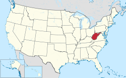
 West Virginia's location within the U.S. | |
| Coordinates: 38°47′N 79°52′W / 38.78°N 79.87°W | |
| Country | |
| State | |
| Founded | October 16, 1787 |
| Named for | Edmund Jennings Randolph |
| Seat | Elkins |
| and largest city | |
| Government | |
| • Commission President | David Kesling (D)[1][2] |
| • County Commission | Cris Siler (R)[3] Chris See (D)[4] |
| Area | |
• Total | 2,700 km2 (1,040 sq mi) |
| • Land | 2,700 km2 (1,040 sq mi) |
| • Water | 0.8 km2 (0.3 sq mi) 0.03% |
| • Rank | 1st |
| Population (2020) | |
• Total | 27,932 |
• Estimate (2021) | 27,806 |
| • Rank | 21st |
| • Density | 10/km2 (27/sq mi) |
| Time zone | UTC−5 (Eastern) |
| • Summer (DST) | UTC−4 (EDT) |
| Area code(s) | 304, 681 |
| Congressional district | 2nd |
| Senate district | 11th |
| House of Delegates district | 66th, 67th |
| Website | https://randolphcountycommissionwv.org/ |
Randolph County is a county located in the U.S. state of West Virginia. As of the 2020 census, the population was 27,932.[5] Its county seat is Elkins.[6] The county was founded in 1787 and is named for Edmund Jennings Randolph.[7]
Randolph County comprises the Elkins, West Virginia, Micropolitan Statistical Area.
- ^ "Candidates' list balloons in Randolph". The Inter-Mountain. Retrieved October 25, 2023.
- ^ "County Commission". Randolph County Commission. Retrieved October 25, 2023.
- ^ "Randolph County 2022 General Election Results". WBOY-TV. Retrieved October 25, 2023.
- ^ "2020 General Election Results: Randolph County". WBOY-TV. Retrieved October 25, 2023.
- ^ "State & County QuickFacts". United States Census Bureau. Retrieved October 19, 2022.
- ^ "Find a County". National Association of Counties. Retrieved June 7, 2011.
- ^ "Randolph County history sources". Archived from the original on October 29, 2013. Retrieved November 26, 2014.


