| Ranquil Formation | |
|---|---|
| Stratigraphic range: Miocene–Pliocene | |
| Type | Geological formation |
| Underlies | Tubul Formation |
| Overlies | Lebu Group |
| Lithology | |
| Primary | Conglomerate with clay and silt matrix, breccia, sandstone, siltstone, mudstone |
| Other | Conglomerate with sand matrix |
| Location | |
| Coordinates | 37°36′S 73°42′W / 37.6°S 73.7°W |
| Approximate paleocoordinates | 37°54′S 71°24′W / 37.9°S 71.4°W |
| Region | Bío Bío Region |
| Country | |
| Type section | |
| Named for | Caleta Ranquil |
| Named by | Juan Tavera |
| Year defined | 1942 |
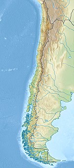
The Ranquil Formation (Spanish: Formación Ranquil) is a Miocene and Pliocene sedimentary formation located in Arauco Province in south–central Chile, including outcrops in Mocha Island. The formation has its greatest thicknesses in the south-west, where its sediments were largely deposited in marine conditions. It overlies unconformably sedimentary formations of the Paleocene-Eocene Lebu Group.[1] The formation is part of the fill of Arauco Basin which is a sedimentary basin that extends south of Concepción.[2]
Macrofossils of the formation are similar to those of Navidad (34° S) and Lacui Formations (43° S), two nearby Miocene marine formations.[3]
The base of the Ranquil Formation is the so-called "main unconformity", which is thought to have been formed by erosion during a period of tectonic inversion.[4]
The formation was first defined in 1942 by Juan Tavera.[1]
- ^ a b García A., Floreal (1968). Ceccioni, Giovanni (ed.). El Terciario de Chile Zona Central (in Spanish). Santiago de Chile: Ediorial Andrés Bello. pp. 25–57.
- ^ Cite error: The named reference
LeRouxetal2008was invoked but never defined (see the help page). - ^ Finger, Kenneth L.; Nielsen, Sven N.; Devries, Thomas J.; Encinas, Alfonso; Peterson, Dwan E. (2007). "Paleontologic evidence for sedimentary displacement in Neogene forearc basins of Central Chile" (PDF). PALAIOS. 22 (1): 3–16. Bibcode:2007Palai..22....3F. doi:10.2110/palo.2005.p05-081r. S2CID 59383760. Retrieved 28 July 2016.
- ^ Becerra, Juan; Contreras-Reyes, Eduardo; Arriagada, César (2013). "Seismic structure and tectonics of the southern Arauco Basin, south-central Chile (~ 38°S)". Tectonophysics. 592: 53–66. Bibcode:2013Tectp.592...53B. doi:10.1016/j.tecto.2013.02.012.
