Nickname: Navy Island | |
|---|---|
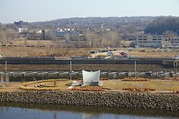
 The east side of Raspberry Island in 2012 | |
 | |
| Etymology | Indigenous wild raspberries |
| Geography | |
| Coordinates | 44°56′32″N 93°05′26″W / 44.9421879°N 93.0904963°W[1] |
| Adjacent to | Mississippi River |
| Area | 87,120 sq ft (8,094 m2) |
| Highest elevation | 696 ft (212.1 m) |
| Administration | |
United States | |
| State | Minnesota |
| City | Saint Paul |
Raspberry Island (formerly called Navy Island) is located in the Mississippi River in Saint Paul, Minnesota, United States. Buildings for the Minnesota Boat Club have sat upon the island since 1885; the Minnesota Boat Club Boathouse structure was built in 1910. Between 1949 and 1968, the island was used by the United States Navy. The City of Saint Paul manages the island as part of the Harriet Island Regional Park. Paths, a plaza, and a bandshell were installed on Raspberry Island during renovations by the city in the early 2000s.
- ^ "Feature Detail Report for: Raspberry Island". Geographic Names Information System. United States Geological Survey. Retrieved June 23, 2014.