This article has multiple issues. Please help improve it or discuss these issues on the talk page. (Learn how and when to remove these messages)
|
Rayalaseema
Dathamandalam, Hiranya Rashtramu | |
|---|---|
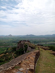
Clockwise from top: Koundinya Wildlife Sanctuary, Lepakshi Monolithic Bull, Tirumala Garudasila, 200 years memorable Pylon in Kadapa, Saumyanatha Temple, Konda Reddy Fort, and Venkateswara Temple. | |
| Nickname: Cultural Region of Andhra Pradesh | |
 Rayalaseema in Andhra Pradesh | |
| Country | |
| State | |
| District(s) | |
| Largest cities | |
| Area | |
• Total | 77,424 km2 (29,894 sq mi) |
| • Rank | 17 |
| Population (2011) | |
• Total | 15,184,908 |
| • Density | 226/km2 (590/sq mi) |
| Languages | |
| • Official | Telugu |
| Time zone | UTC+05:30 (IST) |
| Vehicle registration | AP02, AP03, AP04, AP21, AP39, AP40 |
| Largest airport | Tirupati Airport |


Rayalaseema (IAST: Rāyalasīma) is a geographic region in the Indian state of Andhra Pradesh. It comprises four southern districts of the State, from prior to the districts reorganisation in 2022, namely Kurnool, Anantapur, YSR, and Chittoor. Four new districts were created from these, namely Sri Sathya Sai, Nandyal, Annamayya, and Tirupati.[2] As of 2011 census of India, the western four districts (before the district realignment) of the region had a population of 15,184,908 and cover an area of 77,424 km2 (29,894 sq mi).[3]
- ^ "Andhra Pradesh Fact Sheet". mapsofindia.com.
- ^ Rajeev, M (11 October 2015). "Rayalaseema in a state of discontent". The Hindu. Archived from the original on 8 December 2015. Retrieved 8 December 2015.
- ^ "Population of AP districts(2011)" (PDF). ap.gov.in. p. 14. Archived from the original (PDF) on 12 November 2013. Retrieved 25 May 2014.


