| Raymond Terrace New South Wales | |||||||||||||||
|---|---|---|---|---|---|---|---|---|---|---|---|---|---|---|---|
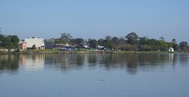
 Raymond Terrace foreshore from the Fitzgerald Bridge | |||||||||||||||
 | |||||||||||||||
| Coordinates | 32°45′41.3″S 151°44′38.6″E / 32.761472°S 151.744056°E | ||||||||||||||
| Population | 13,453 (2021 census)[1][Note 1] | ||||||||||||||
| • Density | 338.87/km2 (877.7/sq mi) [Note 2] | ||||||||||||||
| Established | 1837 | ||||||||||||||
| Postcode(s) | 2324 | ||||||||||||||
| Elevation | 6 m (20 ft)[Note 3] | ||||||||||||||
| Area | 39.7 km2 (15.3 sq mi)[Note 4] | ||||||||||||||
| Time zone | AEST (UTC+10) | ||||||||||||||
| • Summer (DST) | AEDT (UTC+11) | ||||||||||||||
| Location |
| ||||||||||||||
| LGA(s) | Port Stephens Council[2] | ||||||||||||||
| Region | Hunter | ||||||||||||||
| County | Gloucester[3] | ||||||||||||||
| Parish | Eldon[3] | ||||||||||||||
| State electorate(s) | |||||||||||||||
| Federal division(s) | Paterson[6] | ||||||||||||||
| |||||||||||||||
Raymond Terrace, locally known as "The Terrace”, is a town in the Hunter Region of New South Wales, Australia, about 26 km (16 mi) by road north of Newcastle on the Pacific Highway.[2][3] Established in 1837 it is situated at the confluence of the Hunter and Williams rivers.[7][8] The town was named after Lieutenant Raymond, who had explored the Hunter River in 1797 and described the terraced appearance of trees in the area.[3][9] Governor Lachlan Macquarie camped in the area in 1818, using "Raymond's Terrace" as the name for the place where his party had camped.[7]
At the 2021 census Raymond Terrace had a population of 13,453.[1] It is the administrative centre of the Port Stephens local government area as well as a service hub for surrounding rural areas.[10]
- ^ a b Australian Bureau of Statistics (28 June 2022). "Raymond Terrace (State Suburb)". 2021 Census QuickStats. Retrieved 20 October 2022.
- ^ a b "Suburb Search – Local Council Boundaries – Hunter (HT) – Port Stephens". New South Wales Division of Local Government. Archived from the original on 21 June 2014. Retrieved 8 June 2008.
- ^ a b c d "Raymond Terrace". Geographical Names Register (GNR) of NSW. Geographical Names Board of New South Wales. Retrieved 8 June 2008.
- ^ "Port Stephens". New South Wales Electoral Commission. Retrieved 23 November 2019.
- ^ "Maitland". New South Wales Electoral Commission. Retrieved 23 November 2019.
- ^ "Paterson". Australian Electoral Commission. 26 July 2012. Archived from the original on 29 October 2009. Retrieved 1 October 2012.
- ^ a b "Raymond Terrace 1801–2008". Port Stephens Historical Society. 23 August 2011. Retrieved 19 March 2011.
- ^ "Raymond Terrace". Land and Property Management Authority - Spatial Information eXchange. New South Wales Land and Property Information. Retrieved 14 May 2008.
- ^ "Raymond Terrace – Culture and History". Sydney Morning Herald. 20 November 2008. Retrieved 12 November 2013.
- ^ "Port Stephens Council – Contact Council". Port Stephens Council. Archived from the original on 27 November 2012. Retrieved 1 October 2012.
Cite error: There are <ref group=Note> tags on this page, but the references will not show without a {{reflist|group=Note}} template (see the help page).
