Readsboro, Vermont | |
|---|---|
 Readsboro | |
| Nickname: Reads-bury | |
 Readsboro, Vermont | |
| Coordinates: 42°46′20″N 72°56′50″W / 42.77222°N 72.94722°W | |
| Country | United States |
| State | Vermont |
| County | Bennington |
| Communities | Readsboro Heartwellville |
| Area | |
• Total | 36.5 sq mi (94.5 km2) |
| • Land | 36.3 sq mi (94.1 km2) |
| • Water | 0.2 sq mi (0.4 km2) |
| Elevation | 1,663 ft (507 m) |
| Population (2020) | |
• Total | 702 |
| • Density | 19/sq mi (7.5/km2) |
| Time zone | UTC−5 (Eastern (EST)) |
| • Summer (DST) | UTC−4 (EDT) |
| ZIP Codes | 05350, 05352 |
| Area code | 802 |
| FIPS code | 50-58600[1] |
| GNIS feature ID | 1462184[2] |
| Website | readsborovt |
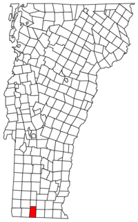
Readsboro is a town in Bennington County, Vermont, United States. The town was named after John Reade, a landholder.[3] The population was 702 at the 2020 census.[4] The hamlet of Heartwellville is in the northern part of Readsboro, approximately 5 miles (8 km) north on Route 100 from the hamlet of Readsboro.[5]
The Readsboro census-designated place consists of the town center and had a population of 297 at the 2020 census.[6]
- ^ "U.S. Census website". United States Census Bureau. Retrieved January 31, 2008.
- ^ "US Board on Geographic Names". United States Geological Survey. October 25, 2007. Retrieved January 31, 2008.
- ^ "Profile for Readsboro, Vermont". ePodunk. Retrieved April 26, 2010.
- ^ "Census - Geography Profile: Readsboro town, Bennington County, Vermont". United States Census Bureau. Retrieved January 4, 2022.
- ^ Coolidge, Austin Jacobs; Mansfield, John Brainard (1859). A History and Description of New England, General and Local. Boston: A.J. Coolidge. pp. 883. OCLC 12762947.
- ^ "Census - Geography Profile: Readsboro CDP, Vermont". United States Census Bureau. Retrieved January 4, 2022.
