| Redfern Sydney, New South Wales | |||||||||||||||
|---|---|---|---|---|---|---|---|---|---|---|---|---|---|---|---|
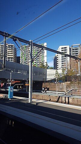
 The buildings of Redfern viewed from the railway station. | |||||||||||||||
 | |||||||||||||||
| Coordinates | 33°53′36″S 151°12′17″E / 33.89334°S 151.20461°E | ||||||||||||||
| Population | 13,072 (SAL 2021)[1] | ||||||||||||||
| Postcode(s) | 2016 | ||||||||||||||
| Elevation | 37 m (121 ft) | ||||||||||||||
| Area | 1.2 km2 (0.5 sq mi) | ||||||||||||||
| Location | 3 km (2 mi) S of Sydney CBD | ||||||||||||||
| LGA(s) | City of Sydney | ||||||||||||||
| State electorate(s) | Newtown | ||||||||||||||
| Federal division(s) | Sydney | ||||||||||||||
| |||||||||||||||
Redfern is an inner southern suburb of Sydney located 3 kilometres (1.9 mi) south of the Sydney central business district and is part of the local government area of the City of Sydney. Strawberry Hills is a locality on the border with Surry Hills. The area experienced the process of gentrification[2] and is subject to extensive redevelopment plans by the state government, to increase the population and reduce the concentration of poverty in the suburb and neighbouring Waterloo (see Redfern-Eveleigh-Darlington).
- ^ Australian Bureau of Statistics (28 June 2022). "Redfern (suburb and locality)". Australian Census 2021 QuickStats. Retrieved 28 June 2022.
- ^ Moore, Matthew (30 April 2011). "Transforming the great southern land". Sydney Morning Herald. Retrieved 19 January 2014.
