| Rednal | |
|---|---|
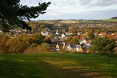
 View from Rednal Hill towards Rubery, with the houses of Rednal in the foreground | |
Location within the West Midlands | |
| Population | 2,000 (2001 Population Census) |
| • Density | 34.8/ha (14.1/acre) |
| OS grid reference | SP002772 |
| Metropolitan borough | |
| Shire county | |
| Metropolitan county | |
| Region | |
| Country | England |
| Sovereign state | United Kingdom |
| Post town | BIRMINGHAM |
| Postcode district | B45 |
| Dialling code | 0121 |
| Police | West Midlands |
| Fire | West Midlands |
| Ambulance | West Midlands |
| UK Parliament | |
Rednal is a residential suburb on the south western edge of metropolitan Birmingham, West Midlands, England, 9 miles (14 kilometres) southwest of Birmingham city centre and forming part of Longbridge parish and electoral ward. Historically it was part of Worcestershire.
Rednal is home to approximately 2,000 residents. The suburb is located in a triangle formed by Rubery and the Bristol Road South to the north and north west, the former MG Rover car factory to the south east and the Lickey Hills and Cofton Hackett Park just south. The popular rural Lickey Hills Country Park is 1⁄2 mile (800 metres) south of Rednal, with Rednal Hill being the nearest peak.
