Rennebu Municipality
Rennebu kommune | |
|---|---|
|
| |
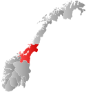
 Trøndelag within Norway | |
 Rennebu within Trøndelag | |
| Coordinates: 62°49′51″N 09°52′28″E / 62.83083°N 9.87444°E | |
| Country | Norway |
| County | Trøndelag |
| District | Orkdalen |
| Established | 1839 |
| • Preceded by | Meldal Municipality |
| Administrative centre | Berkåk |
| Government | |
| • Mayor (2023) | Per Arne Lium (Sp) |
| Area | |
• Total | 947.97 km2 (366.01 sq mi) |
| • Land | 923.84 km2 (356.70 sq mi) |
| • Water | 24.11 km2 (9.31 sq mi) 2.5% |
| • Rank | #123 in Norway |
| Population (2023) | |
• Total | 2,481 |
| • Rank | #255 in Norway |
| • Density | 2.7/km2 (7/sq mi) |
| • Change (10 years) | |
| Demonym | Rennbygg[1] |
| Official language | |
| • Norwegian form | Neutral |
| Time zone | UTC+01:00 (CET) |
| • Summer (DST) | UTC+02:00 (CEST) |
| ISO 3166 code | NO-5022[3] |
| Website | Official website |
Rennebu is a municipality in Trøndelag county, Norway. It is part of the Orkdalen region. The administrative centre of the municipality is the village of Berkåk, located along European route E6. The majority of the population lives in the villages of Berkåk, Innset, Stamnan, Ulsberg, Voll, and Nerskogen.
The 948-square-kilometre (366 sq mi) municipality is the 123rd largest by area out of the 356 municipalities in Norway. Rennebu is the 255th most populous municipality in Norway with a population of 2,481. The municipality's population density is 2.7 inhabitants per square kilometre (7.0/sq mi) and its population has decreased by 2.1% over the previous 10-year period.[4][5]
- ^ "Navn på steder og personer: Innbyggjarnamn" (in Norwegian). Språkrådet.
- ^ "Forskrift om målvedtak i kommunar og fylkeskommunar" (in Norwegian). Lovdata.no.
- ^ Bolstad, Erik; Thorsnæs, Geir, eds. (26 January 2023). "Kommunenummer". Store norske leksikon (in Norwegian). Kunnskapsforlaget.
- ^ Statistisk sentralbyrå. "Table: 06913: Population 1 January and population changes during the calendar year (M)" (in Norwegian).
- ^ Statistisk sentralbyrå. "09280: Area of land and fresh water (km²) (M)" (in Norwegian).

