| Site of Special Scientific Interest | |
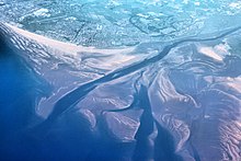
 Aerial view of the Ribble Estuary | |
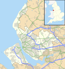
| Location | Merseyside and Lancashire |
|---|---|
| Grid reference | SD375240 |
| Coordinates | 53°43′N 2°58′W / 53.71°N 2.97°W |
| Interest | Biological |
| Area | 9226.3 hectares, 22,798.2 acres (92,261,000 m2) |
| Notification | 1966 (Southport Sanctuary) 1976 (Ribble Estuary) 1984 |
| Designated | 28 November 1985 |
| Reference no. | 325[1] |
| Natural England website | |

The estuaries of the River Ribble and River Alt lie on the Irish Sea coasts of Lancashire and Merseyside in North West England. Together they, and the area of salt marsh, mudflats, and sand dunes between them, form a Special Protection Area and Ramsar site which covers the coastline between Crosby and Lytham St Annes. These protected areas overlap with two sites of special scientific interest, Ribble Estuary and Sefton Coast.
- ^ "Ribble & Alt Estuaries". Ramsar Sites Information Service. Retrieved 25 April 2018.

