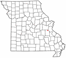
Richwoods, Missouri | |
|---|---|
 Location of Richwoods, Missouri | |
| Coordinates: 38°09′37″N 90°49′41″W / 38.16028°N 90.82806°W | |
| Country | United States |
| State | Missouri |
| County | Washington |
| Settled | 1830 |
| Elevation | 810 ft (250 m) |
| ZIP code | 63071 |
| Area code | 573 |
| GNIS feature ID | 725284[1] |
Richwoods is an unincorporated community in northeastern Washington County, Missouri, United States. It is located on Missouri Route A one mile east of Missouri Route 47,[2] approximately 15 miles west of De Soto and 19 miles south of St. Clair.
- ^ a b U.S. Geological Survey Geographic Names Information System: Richwoods, Missouri
- ^ Richwoods, MO, 7.5 Minute Topographic Quadrangle, USGS, 1981