Ringerike Municipality
Ringerike kommune | |
|---|---|
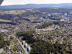
 Town of Hønefoss | |
 Buskerud within Norway | |
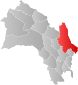
 Ringerike within Buskerud | |
| Coordinates: 60°12′19″N 10°9′9″E / 60.20528°N 10.15250°E | |
| Country | Norway |
| County | Buskerud |
| District | Ringerike |
| Administrative centre | Hønefoss |
| Government | |
| • Mayor (2019) | Kirsten Orebråten (Ap) |
| Area | |
• Total | 1,552 km2 (599 sq mi) |
| • Land | 1,423 km2 (549 sq mi) |
| • Rank | #51 in Norway |
| Population (2020) | |
• Total | 30,641 |
| • Rank | #35 in Norway |
| • Density | 2,155/km2 (5,580/sq mi) |
| • Change (10 years) | |
| Demonym | Ringeriking[1] |
| Official language | |
| • Norwegian form | Bokmål |
| Time zone | UTC+01:00 (CET) |
| • Summer (DST) | UTC+02:00 (CEST) |
| ISO 3166 code | NO-3305[3] |
| Website | Official website |
Ringerike is a municipality in Buskerud county, Norway. It is part of the traditional region of Ringerike. The administrative centre of the municipality is the town of Hønefoss.
The municipality of Ringerike was created on 1 January 1964 after the merger of the town of Hønefoss and the rural municipalities of Hole, Norderhov, Tyristrand, and Ådal. However, the area of Hole was removed from the municipality of Ringerike on 1 January 1977 to become a separate municipality once again. The historic area of Ringerike included not just the modern municipality of Ringerike but also Hole and Krødsherad, Modum, and Sigdal.[4]
- ^ "Navn på steder og personer: Innbyggjarnamn" (in Norwegian). Språkrådet.
- ^ "Forskrift om målvedtak i kommunar og fylkeskommunar" (in Norwegian). Lovdata.no.
- ^ Bolstad, Erik; Thorsnæs, Geir, eds. (2023-01-26). "Kommunenummer". Store norske leksikon (in Norwegian). Kunnskapsforlaget.
- ^ Vol. XIII: A History Of Norway And The Passion And Miracles Of The Blessed Óláfr Viking Society for Northern Research, Anthony Faulkes and Richard Perkins, p. 128

