Rio, Wisconsin | |
|---|---|
 Looking east in downtown Rio on WIS 16 | |
| Nickname: R-10 | |
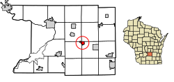
 Location of Rio in Columbia County, Wisconsin | |
| Coordinates: 43°26′52″N 89°14′26″W / 43.44778°N 89.24056°W | |
| Country | |
| State | |
| County | Columbia |
| Area | |
| • Total | 1.26 sq mi (3.27 km2) |
| • Land | 1.25 sq mi (3.25 km2) |
| • Water | 0.01 sq mi (0.02 km2) |
| Elevation | 932 ft (284 m) |
| Population (2020)[3] | |
| • Total | 1,119 |
| • Density | 890/sq mi (340/km2) |
| Time zone | UTC-6 (Central (CST)) |
| • Summer (DST) | UTC-5 (CDT) |
| ZIP code | 53960 |
| Area code | 920 |
| FIPS code | 55-68100[4] |
| GNIS feature ID | 1572330[2] |
| Website | www.riowi.us |
Rio /ˈraɪ.oʊ/[5] (pronounced "rye-oh") is a village in Columbia County, Wisconsin, United States. The population was 1,119 at the 2020 United States Census. It is part of the Madison Metropolitan Statistical Area. The village rests primarily in the town of Otsego. The Village of Rio calls itself "Camper Country USA" due to several campgrounds located near the village. Rio is halfway between Columbus and Portage on Highway 16.
- ^ "2019 U.S. Gazetteer Files". United States Census Bureau. Retrieved August 7, 2020.
- ^ a b "US Board on Geographic Names". United States Geological Survey. October 25, 2007. Retrieved January 31, 2008.
- ^ Cite error: The named reference
wwwcensusgovwas invoked but never defined (see the help page). - ^ "U.S. Census website". United States Census Bureau. Retrieved January 31, 2008.
- ^ Miss Pronouncer: Hear how to pronounce; The Wisconsin pronunciation guide for cities, counties, Indians & lawmakers