| Rio Hondo | |
|---|---|
 | |
| Location | |
| Country | United States |
| State | California |
| Physical characteristics | |
| Source | Santa Anita Creek |
| • location | Irwindale, San Gabriel Valley |
| • coordinates | 34°05′51″N 118°01′16″W / 34.09750°N 118.02111°W[1] |
| • elevation | 320 ft (98 m) |
| Mouth | Los Angeles River |
• location | South Gate |
• coordinates | 33°55′56″N 118°10′30″W / 33.93222°N 118.17500°W[1] |
• elevation | 79 ft (24 m) |
| Length | 16.4 mi (26.4 km)[2] |
| Basin size | 143 sq mi (370 km2)[3] |
| Discharge | |
| • location | below Whittier Narrows Dam[4] |
| • average | 165 cu ft/s (4.7 m3/s)[4] |
| • minimum | 0 cu ft/s (0 m3/s) |
| • maximum | 38,800 cu ft/s (1,100 m3/s) |
| Basin features | |
| Tributaries | |
| • right | Santa Anita Creek, Arcadia Wash, Eaton Wash, Alhambra Wash |
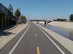
The Rio Hondo (Spanish: Río Hondo, meaning "Deep River") is a tributary of the Los Angeles River in Los Angeles County, California, approximately 16.4 miles (26.4 km) long.[2] As a named river, it begins in Irwindale and flows southwest to its confluence in South Gate, passing through several cities (though not the city of Los Angeles). Above Irwindale its main stem is known as Santa Anita Creek, which extends another 10 miles (16 km) northwards into the San Gabriel Mountains where the source, or headwaters, of the river are found.
- ^ a b "Rio Hondo". Geographic Names Information System. United States Geological Survey, United States Department of the Interior. 1981-01-19. Retrieved 2012-08-24.
- ^ a b U.S. Geological Survey. National Hydrography Dataset high-resolution flowline data. The National Map, accessed March 16, 2011
- ^ "USGS Gage #11102500 on the Rio Hondo near Downey, CA". National Water Information System. U.S. Geological Survey. 1928–1979. Retrieved 2012-08-24.
- ^ a b "USGS Gage #11102300 on the San Gabriel River below Whittier Narrows Dam, CA" (PDF). National Water Information System. U.S. Geological Survey. 1967–2010. Retrieved 2012-08-24.