You can help expand this article with text translated from the corresponding article in German. (March 2021) Click [show] for important translation instructions.
|
Risch-Rotkreuz | |
|---|---|
 | |
| Coordinates: 47°8′N 8°28′E / 47.133°N 8.467°E | |
| Country | Switzerland |
| Canton | Zug |
| District | n.a. |
| Area | |
| • Total | 22.9 km2 (8.8 sq mi) |
| Elevation (Railway station Rotkreuz) | 429 m (1,407 ft) |
| Population (31 December 2018)[2] | |
| • Total | 10,857 |
| • Density | 470/km2 (1,200/sq mi) |
| Time zone | UTC+01:00 (Central European Time) |
| • Summer (DST) | UTC+02:00 (Central European Summer Time) |
| Postal code(s) | 6343 |
| SFOS number | 1707 |
| ISO 3166 code | CH-ZG |
| Localities | Rotkreuz, Risch, Buonas, Holzhäusern |
| Surrounded by | Cham, Dietwil (AG), Honau (LU), Hünenberg, Küssnacht (SZ), Meierskappel (LU), Oberrüti (AG), Root (LU), Zug |
| Twin towns | Risch: Amaroni (Italy) |
| Website | www SFSO statistics |
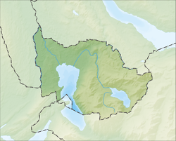
Risch is a municipality in the canton of Zug in Switzerland. It is also promoted as Risch-Rotkreuz. Four villages (Rotkreuz, Risch, Buonas and Holzhäusern) belong to the municipality Risch. On 24 November 2007 it was decided to promote the municipality as Risch-Rotkreuz.[citation needed] The change was made because the village Rotkreuz has become much bigger than Risch.
- ^ a b "Arealstatistik Standard - Gemeinden nach 4 Hauptbereichen". Federal Statistical Office. Retrieved 13 January 2019.
- ^ "Ständige Wohnbevölkerung nach Staatsangehörigkeitskategorie Geschlecht und Gemeinde; Provisorische Jahresergebnisse; 2018". Federal Statistical Office. 9 April 2019. Retrieved 11 April 2019.


