| River Boyne | |
|---|---|
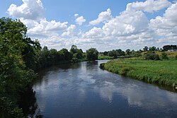
 River Boyne at Brú na Bóinne. | |
 | |
| Etymology | Proto-Celtic *bou-windā, "white cow" |
| Native name | An Bhóinn (Irish) |
| Location | |
| Country | Ireland |
| Region | Leinster |
| Counties | Kildare, Offaly, Meath, Louth |
| Physical characteristics | |
| Source | Trinity Well, Newberry Hall, near Carbury |
| • location | County Kildare |
| • coordinates | 53°21′07″N 6°57′25″W / 53.351906542854074°N 6.956809100021702°W |
| Mouth | Irish Sea |
• location | Between Mornington, County Meath and Baltray, County Louth |
• coordinates | 53°43′18″N 6°14′17″W / 53.72173°N 6.23813°W |
| Length | 112 km (70 mi) |
| Basin size | 2,695 km2 (1,041 sq mi) |
| Discharge | |
| • average | 38.8 m3/s (1,370 cu ft/s) |
| Basin features | |
| Tributaries | |
| • right | River Blackwater |

The River Boyne (Irish: An Bhóinn or Abhainn na Bóinne) is a river in Leinster, Ireland, the course of which is about 112 kilometres (70 mi) long. It rises at Trinity Well, Newberry Hall, near Carbury, County Kildare, and flows towards the Northeast through County Meath to reach the Irish Sea between Mornington, County Meath, and Baltray, County Louth.