| River Burn Bourne Burne (archaic) | |
|---|---|
 River Burn near Masham | |
| Location | |
| United Kingdom | England |
| County | North Yorkshire |
| Physical characteristics | |
| Source | |
| • location | Little Haw |
| • coordinates | 54°12′08.4″N 1°51′36.1″W / 54.202333°N 1.860028°W |
| • elevation | 1,509 feet (460 m) |
| Mouth | River Ure |
• location | Masham |
• coordinates | 54°12′46.9″N 1°38′51.4″W / 54.213028°N 1.647611°W |
• elevation | 230 feet (70 m) |
| Length | 12 miles (19 km) |
| Basin size | 27 square miles (69.5 km2) |
| Basin features | |
| River system | River Ure |
| Tributaries | |
| • left | Slee House Gill House Gill Low Gill Birk Gill Beck How Gill Gir Beck Sinney Keld Swinney Beck |
| • right | Spruce Gill Beck Pott Beck Sole Beck Eller Beck Den Beck |
| Waterfalls | High House Farm |
River Burn | ||||||||||||||||||||||||||||||||||||||||||||||||||||||||||||||||||||||||||||||||||||||||||||||||||||||||||||||||||||||||||||||||||||||||||||||||||||||||||||||||||||||||||||||||||||||||||||||||||||||||||||||||||
|---|---|---|---|---|---|---|---|---|---|---|---|---|---|---|---|---|---|---|---|---|---|---|---|---|---|---|---|---|---|---|---|---|---|---|---|---|---|---|---|---|---|---|---|---|---|---|---|---|---|---|---|---|---|---|---|---|---|---|---|---|---|---|---|---|---|---|---|---|---|---|---|---|---|---|---|---|---|---|---|---|---|---|---|---|---|---|---|---|---|---|---|---|---|---|---|---|---|---|---|---|---|---|---|---|---|---|---|---|---|---|---|---|---|---|---|---|---|---|---|---|---|---|---|---|---|---|---|---|---|---|---|---|---|---|---|---|---|---|---|---|---|---|---|---|---|---|---|---|---|---|---|---|---|---|---|---|---|---|---|---|---|---|---|---|---|---|---|---|---|---|---|---|---|---|---|---|---|---|---|---|---|---|---|---|---|---|---|---|---|---|---|---|---|---|---|---|---|---|---|---|---|---|---|---|---|---|---|---|---|---|
| ||||||||||||||||||||||||||||||||||||||||||||||||||||||||||||||||||||||||||||||||||||||||||||||||||||||||||||||||||||||||||||||||||||||||||||||||||||||||||||||||||||||||||||||||||||||||||||||||||||||||||||||||||
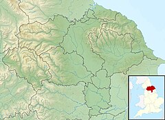
The River Burn is a river that flows wholly within North Yorkshire, England. The river starts as several small streams on Masham Moor and drains Colsterdale flowing eastwards before emptying into the River Ure just south of Masham. Conservation work on removing a weir, and introducing fish to the river in 2016, has meant that salmon have been recorded spawning in the river for the first time in over 100 years.[1]
Whilst the River Burn valley is not in Nidderdale, almost all of it is included in the Nidderdale Area of Outstanding Natural Beauty.[2][3]
- ^ "River fishing". Swinton Estate. Retrieved 28 March 2021.
- ^ "38 River Burn Valley Farmland" (PDF). www.harrogate.gov.uk. Harrogate Borough Council. February 2004. p. 1. Retrieved 28 March 2021.
- ^ "6 Upper Colsterdale Valley | Harrogate Borough Council" (PDF). www.harrogate.gov.uk. February 2004. p. 1. Retrieved 2 November 2017.
