| River Derwent | |
|---|---|
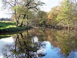
 The River Derwent, near Hathersage | |
 | |
| Location | |
| Country | England |
| Counties | Derbyshire |
| Physical characteristics | |
| Source | |
| • location | Bleaklow, east of Glossop |
| • coordinates | 53°28′01″N 1°48′47″W / 53.466894°N 1.813175°W |
| Mouth | |
• location | Derwent Mouth, River Trent |
• coordinates | 52°52′26″N 1°19′13″W / 52.8738°N 1.3203°W |
| Length | 80 km (50 mi) |
| Basin features | |
| Tributaries | |
| • left | Bentley Brook, River Amber |
| • right | River Westend, River Ashop, River Noe, River Wye, River Ecclesbourne |
River Derwent | |||||||||||||||||||||||||||||||||||||||||||||||||||||||||||||||||||||||||||||||||||||||||||||||||||||||||||||||||||||||||||||||||||||||||||||||||||||||||||||||||||||||||||||||||||||||||||||
|---|---|---|---|---|---|---|---|---|---|---|---|---|---|---|---|---|---|---|---|---|---|---|---|---|---|---|---|---|---|---|---|---|---|---|---|---|---|---|---|---|---|---|---|---|---|---|---|---|---|---|---|---|---|---|---|---|---|---|---|---|---|---|---|---|---|---|---|---|---|---|---|---|---|---|---|---|---|---|---|---|---|---|---|---|---|---|---|---|---|---|---|---|---|---|---|---|---|---|---|---|---|---|---|---|---|---|---|---|---|---|---|---|---|---|---|---|---|---|---|---|---|---|---|---|---|---|---|---|---|---|---|---|---|---|---|---|---|---|---|---|---|---|---|---|---|---|---|---|---|---|---|---|---|---|---|---|---|---|---|---|---|---|---|---|---|---|---|---|---|---|---|---|---|---|---|---|---|---|---|---|---|---|---|---|---|---|---|---|---|
| |||||||||||||||||||||||||||||||||||||||||||||||||||||||||||||||||||||||||||||||||||||||||||||||||||||||||||||||||||||||||||||||||||||||||||||||||||||||||||||||||||||||||||||||||||||||||||||
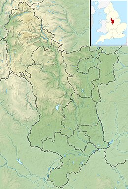
The Derwent is a river in Derbyshire, England. It is 50 miles (80 km)[1] long and is a tributary of the River Trent, which it joins south of Derby.[2] Throughout its course, the river mostly flows through the Peak District and its foothills.
Much of the river's route, with the exception of the city of Derby, is rural. However, the river has also seen many human uses, and between Matlock and Derby was one of the cradles of the Industrial Revolution. It is the site of the Derwent Valley Mills, the first industrial-scale cotton mills. Today it provides a water supply to several surrounding cities, and its steep-sided valley is an important communications corridor through the uplands of the Peak District.[3]
The scenery of the Derwent valley attracts many tourists. The upper reaches pass through the Peak District National Park, whilst the middle reaches around the old spa town of Matlock Bath offer souvenir shops and amusement arcades, together with attractions such as the Heights of Abraham and its cable car.[3][4]
- ^ "River Derwent". Peak District Information. Archived from the original on 11 November 2021. Retrieved 29 August 2022.
- ^ 1:50 000 Scale Colour Raster (Map). Ordnance Survey. 2000.
- ^ a b "River Derwent". Derbyshire UK. Retrieved 9 July 2009.
- ^ "Matlock Bath". Derbyshire UK. Retrieved 9 July 2009.
