| River Riccal | |
|---|---|
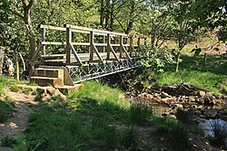
 Footbridge over the river Riccal 54°18′3.38″N 1°3′28.26″W / 54.3009389°N 1.0578500°W | |
 | |
| Location | |
| Country | England |
| Physical characteristics | |
| Source | |
| • location | Confluence of Bonfield Gill and Bogmire Gill near Helmsley |
| • coordinates | 54°17′52″N 1°3′40″W / 54.29778°N 1.06111°W |
| • elevation | 130 metres (430 ft) |
| Mouth | |
• location | River Rye |
• coordinates | 54°12′14″N 0°54′58″W / 54.20389°N 0.91611°W |
• elevation | 24 metres (79 ft) |
| Length | 18.36 kilometres (11.41 mi) |
| Basin size | 57.6 square kilometres (22.2 sq mi) |
The River Riccal is a river of North Yorkshire, England, lying within the North York Moors National Park. It is a tributary of the River Rye, which in turn is a tributary of the River Derwent. The name originates in the fourteenth century as Ricolvegraines means Rye Calf, where Calf is a small island near a larger one. This describes the way the river, and those nearby, form islands as their nature changes due to meandering.[1]
Some writers have misspelled the river Riccall,[2] possibly in confusion with an unconnected village in North Yorkshire. The Riccal name was also the name of a Rural District before 1935. The river is under the management of the Rye Internal Drainage Board, a member of the Vale of Pickering IDBs.[3]
- ^ "Name". Retrieved 23 August 2011.
- ^ Herbert Read, 'Exile's Lament', in Herbert Read, Collected Poems (London: Faber and Faber, 1966)
- ^ "Management". Archived from the original on 3 October 2011. Retrieved 23 August 2011.