| River Spen | |
|---|---|
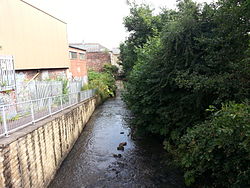
 Spen River running east through Millbridge, Liversedge into Heckmondwike | |
 | |
| Location | |
| Country | England |
| Physical characteristics | |
| Source | |
| • location | Confluence of Hunsworth Beck and Nann Hall Beck in Cleckheaton |
| • coordinates | 53°43′59″N 1°43′05″W / 53.73306°N 1.71806°W |
| • elevation | 81 metres (266 ft) |
| Mouth | |
• location | River Calder at Dewsbury |
• coordinates | 53°40′49″N 1°39′4″W / 53.68028°N 1.65111°W |
• elevation | 42 metres (138 ft) |
| Length | 8 kilometres (5.0 mi) |
| Basin size | 46.3 square kilometres (17.9 sq mi)[1] |
The River Spen or Spen Beck, in West Yorkshire, England is a tributary of the River Calder. It rises north of Cleckheaton, runs through Liversedge and flows into the Calder to the south of Dewsbury at Ravensthorpe. The average rainfall for the river valley of between 600–1000mm per annum when combined with the steep narrow river channel, makes the Spen susceptible to regular flooding.[2] It is referred to in the name of the local parliamentary constituency, Batley and Spen, to account for the villages and suburbs of Batley in the Spen Valley, such as Liversedge and Gomersal.
- ^ "Spen Statistics". National River Flow Archives. Centre for Ecology & Hydrology. Retrieved 18 February 2011.
- ^ "River flow" (PDF). Retrieved 21 August 2011.