| Tame | |
|---|---|
 River Tame near Reddish Vale | |
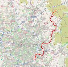
 The River Tame is highlighted in red Coordinates: 53°24′51″N 2°09′25″W / 53.4142°N 2.15689°W | |
| Location | |
| Country | England |
| Region | Greater Manchester |
| Physical characteristics | |
| Source | |
| • location | west of Buckstones Moss, West Yorkshire |
| • coordinates | 53°37′07″N 2°00′13″W / 53.6187°N 2.0035°W |
| • elevation | 473 m (1,552 ft) |
| Mouth | River Mersey |
• location | Stockport |
• coordinates | 53°24′51″N 2°09′23″W / 53.4143°N 2.1565°W |
• elevation | 40[1] m (130 ft) |
| Length | 47.7 km (29.6 mi) |
| Basin size | 146 km2 (56 sq mi)[2] |
| Basin features | |
| River system | River Mersey |
 | |
The River Tame flows through Greater Manchester, England. It rises on Denshaw Moor and flows to Stockport where it joins the River Goyt to form the River Mersey.
- ^ Boyce, D (August 2005). "Mersey and Bollin Catchment abstraction management strategy" (PDF). Environment Agency North West, Warrington. p. 5. Archived from the original (PDF) on 22 July 2012. Retrieved 13 March 2007.
- ^ Boyce, D (March 2004). "The Tame, Goyt and Etherow catchment abstraction management strategy" (PDF). Environment Agency, Warrington. p. 6. Archived from the original (PDF) on 22 July 2012. Retrieved 13 March 2007.