| Thet | |
|---|---|
 River Thet at Brettenham | |
| Etymology | From Thetford, in turn from 'Theodford' which is Anglo-Saxon for 'Peoples Ford' |
| Location | |
| Country | England |
| Region | Norfolk |
| Physical characteristics | |
| Source | |
| • location | Deopham Green |
| • coordinates | 52°33′03″N 1°00′07″E / 52.5507°N 1.0019°E |
| • elevation | 53 m (174 ft) |
| Mouth | River Little Ouse |
• location | Thetford |
• coordinates | 52°24′41″N 0°44′55″E / 52.4113°N 0.7485°E |
• elevation | 10 m (33 ft) |
| Length | 34.3 km (21.3 mi) |
| Basin size | ≈225km2 |
| Basin features | |
| River system | River Little Ouse |
| Tributaries | |
| • left | Wittle
Stream from Middle Harling Fen Stream from Old Buckenham Fen |
| • right | Stream from Roudham village Stream from Hockham |
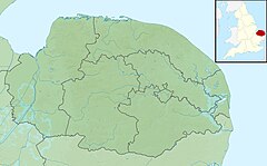
The River Thet is a river in Norfolk, England and is a tributary of the River Little Ouse.It rises in Breckland with sources in Deopham Green and Rockland All Saints[1] and joins the Little Ouse in Thetford after flowing approximately southwest.
[2] The primary sources for its various small tributaries include the calcareous valley fen SSSIs Swangey Fen,[3] Old Buckenham Fen,[4] Middle Harling Fen[5] and Kenninghall and Banham Fens with Quidenham Mere.[6]Carr woodland is also a prevalent habitat throughout the floodplain where open wetlands have been invaded by scrub. The underlying geology is clay/loam over chalk for the easternmost parts of the river's course and sand/gravel over chalk for the majority of the river.
- ^ TM003940
- ^ TL870828
- ^ https://designatedsites.naturalengland.org.uk/PDFsForWeb/Citation/1000134.pdf [bare URL PDF]
- ^ https://designatedsites.naturalengland.org.uk/PDFsForWeb/Citation/1003600.pdf [bare URL PDF]
- ^ https://designatedsites.naturalengland.org.uk/PDFsForWeb/Citation/1000696.pdf [bare URL PDF]
- ^ https://designatedsites.naturalengland.org.uk/PDFsForWeb/Citation/1000583.pdf [bare URL PDF]
