This article has multiple issues. Please help improve it or discuss these issues on the talk page. (Learn how and when to remove these messages)
|
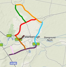
The City of Peterborough in East Anglia has an extensive and well integrated road network, owing partly to its status as a new town. Since the 1960s, the city has seen considerable expansion and its various suburbs are linked by a system of parkways.

Despite its large-scale growth, Peterborough has the fastest peak and off-peak travel times for a city of its size in the United Kingdom, due to the construction of the parkways. The Local Transport Plan anticipates expenditure totalling around £180 million for the period up to 2010 on major road schemes to accommodate future development.[1]
The A1/A1(M) broadly follows the path of the historic Great North Road from London, through Peterborough (Junction 17), continuing north a further 335 miles (539 km) to central Edinburgh.
Cite error: There are <ref group=upper-alpha> tags or {{efn-ua}} templates on this page, but the references will not show without a {{reflist|group=upper-alpha}} template or {{notelist-ua}} template (see the help page).
- ^ The Second Local Transport Plan Peterborough City Council, March 2006