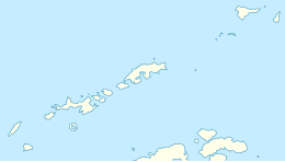
 Location of Robert Island in the South Shetland Islands | |
| Geography | |
|---|---|
| Location | Antarctica |
| Coordinates | 62°24′S 59°30′W / 62.400°S 59.500°W |
| Archipelago | South Shetland Islands |
| Area | 132 km2 (51 sq mi) |
| Length | 11 mi (18 km) |
| Width | 8 mi (13 km) |
| Administration | |
| Administered under the Antarctic Treaty System | |
| Demographics | |
| Population | 0 |
| Punta Prat Lighthouse | |
| Foundation | concrete base |
| Construction | fiber glass tower |
| Height | 7 m (23 ft) |
| Shape | cylindrical tower |
| Markings | yellow tower with orange horizontal bands[1] |
| Power source | solar power |
| Focal height | 25 m (82 ft) |
| Range | 7 nmi (13 km; 8.1 mi) |
| Characteristic | Fl W 10s |
Robert Island or Mitchells Island or Polotsk Island or Roberts Island is an island 11 miles (18 km) long and 8 miles (13 km) wide, situated between Nelson Island and Greenwich Island in the South Shetland Islands, Antarctica. Robert Island is located at 62°24′S 59°30′W / 62.400°S 59.500°W. Its surface area is 132 km2 (51 sq mi).[2] The name "Robert Island" dates back to around 1821 and is now established in international usage.
Much of the Coppermine Peninsula in the west of the island is made up by a perched strandflat surface that was at sea level in the past.[3]
Captain Richard Fildes may have named Robert Island for his brig Robert.[4] Fildes was sealing in the South Shetlands in 1821–1822 until ice destroyed his vessel in March 1822. Fildes Strait is named for him.

- ^ List of Lights, Pub. 111: The West Coasts of North and South America (Excluding Continental U.S.A. and Hawaii), Australia, Tasmania, New Zealand, and the Islands of the North and South Pacific Oceans (PDF). List of Lights. United States National Geospatial-Intelligence Agency. 2017.
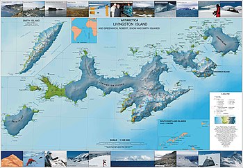
- ^ L.L. Ivanov. Antarctica: Livingston Island and Greenwich, Robert, Snow and Smith Islands. Scale 1:120000 topographic map. Troyan: Manfred Wörner Foundation, 2010. ISBN 978-954-92032-9-5 (First edition 2009. ISBN 978-954-92032-6-4)
- ^ Serrano, Enrique; López-Martínez, Jerónimo (1997). "Geomorfología de la península Coppermine, isla Robert, islas Shetland del Sur, Antártica" (PDF). Serie Científica (in Spanish). 47. INACh: 19–29. Archived from the original (PDF) on 11 September 2017. Retrieved 11 September 2017.
- ^ Australian Antarctic Data Centre Gazeteer" Robert Island.

