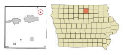
Rock Falls, Iowa | |
|---|---|
 Location of Rock Falls, Iowa | |
| Coordinates: 43°12′22″N 93°5′10″W / 43.20611°N 93.08611°W | |
| Country | |
| State | |
| County | Cerro Gordo |
| Incorporated | July 17, 1882[1] |
| Area | |
| • Total | 0.21 sq mi (0.54 km2) |
| • Land | 0.21 sq mi (0.54 km2) |
| • Water | 0.00 sq mi (0.00 km2) |
| Elevation | 1,102 ft (336 m) |
| Population (2020) | |
| • Total | 150 |
| • Density | 724.64/sq mi (279.85/km2) |
| Time zone | UTC-6 (Central (CST)) |
| • Summer (DST) | UTC-5 (CDT) |
| ZIP code | 50467 |
| Area code | 641 |
| FIPS code | 19-68025 |
| GNIS feature ID | 0460739 |
Rock Falls is a city in Cerro Gordo County, Iowa, United States, along the Shell Rock River. The population was 150 at the time of the 2020 census.[3] It is part of the Mason City Micropolitan Statistical Area. A post office named Shell Rock Falls opened in 1855; in 1872 this was changed to Rock Falls.[4]
- ^ "List of Incorporated Cities" (PDF). Iowa Secretary of State Paul D. Pate. November 2, 2022. Retrieved November 5, 2024.
- ^ "2020 U.S. Gazetteer Files". United States Census Bureau. Retrieved March 16, 2022.
- ^ "2020 Census State Redistricting Data". census.gov. United states Census Bureau. Retrieved August 12, 2021.
- ^ "US Post Offices". Blevins, Cameron; Helbock, Richard W. 2021. Retrieved October 31, 2024.