| Rockcastle River | |
|---|---|
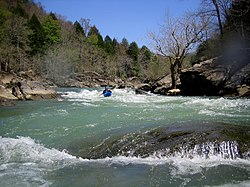
 A kayak on the Rockcastle River | |
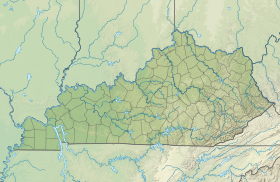
| Location | |
| Country | United States |
| State | Kentucky |
| Physical characteristics | |
| Source | Jackson County line |
| • location | kentucky |
| • coordinates | 37°20′10″N 84°7′8″W / 37.33611°N 84.11889°W[1] |
| Mouth | Cumberland River |
• location | kentucky |
• coordinates | 36°57′36″N 84°21′25″W / 36.96000°N 84.35694°W[1] |
• elevation | 888 ft (271 m)[1] |
| Length | 55 mi (89 km) |
| Basin size | 4,100 sq mi (11,000 km2) |
The Rockcastle River is a 54.8-mile-long (88.2 km)[2] river primarily in Rockcastle County, Kentucky, United States. It is a tributary of the Cumberland River and therefore, via the Ohio River, part of the Mississippi River watershed.
- ^ a b c U.S. Geological Survey Geographic Names Information System: Rockcastle River
- ^ U.S. Geological Survey. National Hydrography Dataset high-resolution flowline data. The National Map, accessed June 8, 2011
