Rockdale County | |
|---|---|
 Rockdale County Courthouse in Conyers | |
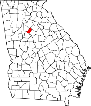
 Location within the U.S. state of Georgia | |
 Georgia's location within the U.S. | |
| Coordinates: 33°39′N 84°02′W / 33.65°N 84.03°W | |
| Country | |
| State | |
| Founded | October 18, 1870 |
| Named for | Rockdale Baptist Church |
| Seat | Conyers |
| Largest city | Conyers |
| Area | |
• Total | 132 sq mi (340 km2) |
| • Land | 130 sq mi (300 km2) |
| • Water | 2.3 sq mi (6 km2) 1.7% |
| Population (2020) | |
• Total | 93,570 |
| Time zone | UTC−5 (Eastern) |
| • Summer (DST) | UTC−4 (EDT) |
| Congressional district | 4th |
| Website | rockdalecountyga.gov |
Rockdale County is a county located in the North Central portion in the U.S. state of Georgia. As of the 2020 census, the population was 93,570 up from 85,215 in 2010.[1][2] The county seat is Conyers.[3]
Rockdale County is included in Metro Atlanta.
- ^ "State & County QuickFacts". United States Census Bureau. Archived from the original on July 3, 2011. Retrieved June 25, 2014.
- ^ US Census Bureau, 2020 Report, Rockdale County, Georgia
- ^ "Find a County". National Association of Counties. Retrieved June 7, 2011.

