Rockville, Utah | |
|---|---|
 | |
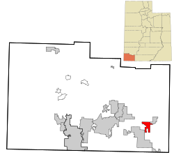
 Location in Washington County and the state of Utah | |
| Coordinates: 37°08′25″N 113°02′48″W / 37.14028°N 113.04667°W | |
| Country | United States |
| State | Utah |
| County | Washington |
| Settled | 1860 |
| Incorporated | June 30, 1987 |
| Area | |
• Total | 8.47 sq mi (21.95 km2) |
| • Land | 8.47 sq mi (21.95 km2) |
| • Water | 0.00 sq mi (0.00 km2) |
| Elevation | 3,927 ft (1,197 m) |
| Population (2010) | |
• Total | 245 |
| • Density | 31.75/sq mi (12.26/km2) |
| Time zone | UTC-7 (Mountain (MST)) |
| • Summer (DST) | UTC-6 (MDT) |
| ZIP code | 84763 |
| Area code | 435 |
| FIPS code | 49-64560[3] |
| GNIS feature ID | 2412565[2] |
Rockville is a town in Washington County, Utah, United States. It is located along the Virgin River near the mouth of Zion Canyon. The city lies just outside the park boundary for Zion National Park; the park entrance is located approximately 5 miles (8 km) northeast of the town.
- ^ "2019 U.S. Gazetteer Files". United States Census Bureau. Retrieved August 7, 2020.
- ^ a b U.S. Geological Survey Geographic Names Information System: Rockville, Utah
- ^ "U.S. Census website". United States Census Bureau. Retrieved January 31, 2008.