| Rocky Neck State Park | |
|---|---|
 Bride Brook Salt Marsh | |
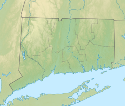
| Location | East Lyme, Connecticut, United States |
| Coordinates | 41°18′15″N 72°14′52″W / 41.30417°N 72.24778°W[1] |
| Area | 708 acres (287 ha) |
| Elevation | 66 feet (20 m)[1] |
| Established | 1931 |
| Administered by | Connecticut Department of Energy and Environmental Protection |
| Designation | Connecticut state park |
| Website | Official website |
Rocky Neck Pavilion | |
 | |
| Location | Lands End Point, Rocky Neck State Park, East Lyme, Connecticut |
| Area | 6.5 acres (2.6 ha) |
| Built | 1934 |
| Built by | Federal Emergency Relief Administration (FERA), Civilian Works Administration (CWA) |
| Architect | Barker, Russell F., et al. |
| Architectural style | Rustic |
| MPS | Connecticut State Park and Forest Depression-Era Federal Work Relief Programs Structures TR |
| NRHP reference No. | 86001745 |
| Added to NRHP | September 4, 1986 |
Rocky Neck State Park is a public recreation area encompassing 710 acres (290 ha) on Long Island Sound in the town of East Lyme, Connecticut, United States. The park encompasses a tidal river, a broad salt marsh, white sand beaches, rocky shores, and a large stone pavilion dating from the 1930s. It is managed by the Connecticut Department of Energy and Environmental Protection.[2]
- ^ a b "Rocky Neck". Geographic Names Information System. United States Geological Survey, United States Department of the Interior.
- ^ Cite error: The named reference
DEEPwas invoked but never defined (see the help page).

