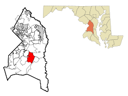
Rosaryville, Maryland | |
|---|---|
 Location of Rosaryville, Maryland | |
| Coordinates: 38°46′4″N 76°50′8″W / 38.76778°N 76.83556°W | |
| Country | |
| State | |
| County | |
| Area | |
| • Total | 9.20 sq mi (23.82 km2) |
| • Land | 9.18 sq mi (23.78 km2) |
| • Water | 0.01 sq mi (0.04 km2) |
| Elevation | 223 ft (68 m) |
| Population (2020) | |
| • Total | 11,548 |
| • Density | 1,257.54/sq mi (485.55/km2) |
| Time zone | UTC−5 (Eastern (EST)) |
| • Summer (DST) | UTC−4 (EDT) |
| Area code(s) | 301, 240 |
| FIPS code | 24-68300 |
| GNIS feature ID | 0597990 |
Rosaryville is an unincorporated area and census-designated place (CDP) in Prince George's County, Maryland, United States, located south of Cinton and Upper Marlboro beside U.S. Route 301.[2] Per the 2020 census, the population was 11,548.[3] including housing developments and rural open space. It was named for a local Roman Catholic church.[4] Close to Rosaryville are the Marlton housing development, Maryland Veterans Cemetery, the Southern Maryland Farmers Market, and Rosaryville State Park.
- ^ "2020 U.S. Gazetteer Files". United States Census Bureau. Retrieved April 26, 2022.
- ^ U.S. Geological Survey Geographic Names Information System: Rosaryville, Maryland
- ^ "Rosaryville CDP, Maryland". United States Census Bureau. Retrieved April 15, 2022.
- ^ "Our Parish History". St. Mary of the Assumption Church. Retrieved November 3, 2017.