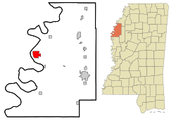
Rosedale, Mississippi | |
|---|---|
City | |
 | |
| Motto: The Delta City of Brotherly Love | |
 Location of Rosedale, Mississippi | |
| Coordinates: 33°51′13″N 91°1′37″W / 33.85361°N 91.02694°W | |
| Country | United States |
| State | Mississippi |
| County | Bolivar |
| Area | |
• Total | 5.48 sq mi (14.19 km2) |
| • Land | 5.42 sq mi (14.02 km2) |
| • Water | 0.06 sq mi (0.16 km2) |
| Elevation | 151 ft (46 m) |
| Population (2020) | |
• Total | 1,584 |
| • Density | 292.52/sq mi (112.95/km2) |
| Time zone | UTC-6 (Central (CST)) |
| • Summer (DST) | UTC-5 (CDT) |
| ZIP code | 38769 |
| Area code | 662 |
| FIPS code | 28-63720 |
| GNIS feature ID | 0676870 |
| Website | www |
Rosedale is a city in Bolivar County, Mississippi, United States. The population was 1,873 at the 2010 census,[2] down from 2,414 in 2000. Located in an agricultural area, the city had a stop on the Yazoo and Mississippi Valley Railroad, which carried many migrants north out of the area in the first half of the 20th century.
- ^ "2020 U.S. Gazetteer Files". United States Census Bureau. Retrieved July 24, 2022.
- ^ "Geographic Identifiers: 2010 Demographic Profile Data (G001): Rosedale city, Mississippi". U.S. Census Bureau, American Factfinder. Archived from the original on February 12, 2020. Retrieved January 21, 2014.
