Rosholt, South Dakota | |
|---|---|
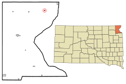
 Location in Roberts County and the state of South Dakota | |
| Coordinates: 45°51′58″N 96°43′54″W / 45.86611°N 96.73167°W | |
| Country | United States |
| State | South Dakota |
| County | Roberts |
| Incorporated | 1913[1] |
| Area | |
• Total | 0.30 sq mi (0.77 km2) |
| • Land | 0.30 sq mi (0.77 km2) |
| • Water | 0.00 sq mi (0.00 km2) |
| Elevation | 1,083 ft (330 m) |
| Population | |
• Total | 379 |
| • Density | 1,280.41/sq mi (494.95/km2) |
| Time zone | UTC-6 (Central (CST)) |
| • Summer (DST) | UTC-5 (CDT) |
| ZIP code | 57260 |
| Area code | 605 |
| FIPS code | 46-56340[5] |
| GNIS feature ID | 1267555[3] |
| Website | http://www.rosholtsd.com/ |
Rosholt is a town in Roberts County, South Dakota, United States. The population was 379 at the 2020 census.[6]
Rosholt was laid out in 1913, and named in honor of Julius Rosholt, who was credited with bringing the railroad to town.[7]
- ^ "SD Towns" (PDF). South Dakota State Historical Society. Retrieved February 15, 2010.
- ^ "ArcGIS REST Services Directory". United States Census Bureau. Retrieved October 15, 2022.
- ^ a b U.S. Geological Survey Geographic Names Information System: Rosholt, South Dakota
- ^ Cite error: The named reference
USCensusDecennial2020CenPopScriptOnlywas invoked but never defined (see the help page). - ^ "U.S. Census website". United States Census Bureau. Retrieved January 31, 2008.
- ^ "U.S. Census Bureau: Rosholt town, South Dakota". www.census.gov. United States Census Bureau. Retrieved January 28, 2022.
- ^ Federal Writers' Project (1940). South Dakota place-names, v.1-3. University of South Dakota. p. 59.