| Ross | |
|---|---|
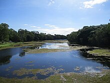
 Ross River as it runs through Townsville suburbs, with Aplins Weir visible on right | |
Location of Ross River river mouth in Queensland | |
| Etymology | W. A. Ross, a colonial settler[1] |
| Location | |
| Country | Australia |
| State | Queensland |
| Region | North Queensland |
| City | Townsville |
| Physical characteristics | |
| Source | Hervey Range |
| • location | below Pepper Pot Mountain |
| • coordinates | 19°34′07″S 146°43′12″E / 19.56861°S 146.72000°E |
| • elevation | 92 m (302 ft) |
| Mouth | Coral Sea |
• location | South Townsville |
• coordinates | 19°15′25″S 146°50′58″E / 19.25694°S 146.84944°E |
• elevation | 0 m (0 ft) |
| Length | 49 km (30 mi) |
| Basin size | 1,340 km2 (520 sq mi) to 917.1 km2 (354.1 sq mi)[2] |
| Discharge | |
| • location | Near mouth |
| • average | 9.3 m3/s (290 GL/a)[2] |
| Basin features | |
| Tributaries | |
| • left | Ross Creek, Goondi Creek |
| • right | Stuart Creek |
| Reservoirs | Black Weir; Gleeson's Weir; Aplin's Weir; Ross River Dam |
| [3] | |
The Ross River is a river in North Queensland, Australia. The 49-kilometre (30 mi) long river flows through the city of Townsville and empties into the Coral Sea. It is the major waterway flowing through Townsville and the city's main source of drinking water.[4]
The river is named in 1864 after William Alfred Ross (-1887), first publican of the settlement who later became a mayor of Townsville in 1868.[5][6]
- ^ "Our story, our vision". About the Port. Port of Townsville. 31 July 2015. Retrieved 15 October 2015.
- ^ a b "East Coastal Watersheds".
- ^ "Map of Ross River, QLD". Bonzle Digital Atlas of Australia. Retrieved 14 October 2015.
- ^ "Water resources - Overview - Queensland - Basin & Surface Water Management Area: Ross River". Australian Natural Resources Atlas. Department of the Environment, Water, Heritage and the Arts. Archived from the original on 4 October 2009. Retrieved 22 February 2010.
- ^ "Ross River – river in Townsville City (entry 29108)". Queensland Place Names. Queensland Government. Retrieved 25 January 2018.
- ^ "Settlers savour progress in Criterion Hotel". Townsville Bulletin. 6 February 2015. Retrieved 19 January 2018.
