| Route 227 | ||||
|---|---|---|---|---|
| כביש 227 | ||||
 | ||||
| Route information | ||||
| Length | 33 km (21 mi) | |||
| Existed | 1950–present | |||
| Major junctions | ||||
| West end | Nahal Ma'ale Junction | |||
| East end | Ein Hatzeva Junction | |||
| Location | ||||
| Country | Israel | |||
| Highway system | ||||
| ||||
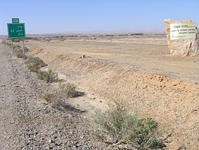
Route 227 (Hebrew: כביש 227, Kvish 227) is a 34-kilometre (21 mi) road in the eastern Negev desert of Israel. It starts from an intersection with Route 206 in the northwest and ends in Ir Ovot in the southeast, intersecting with Highway 90.[1] It has one at-grade intersection at 19 km. The original road (since upgraded) was laid by British land surveyors in 1927. Prior to 1956, this was the primary route from Beersheba to Eilat.[2]

Scorpions' Pass (Hebrew: מעלה עקרבים, Ma'ale Akrabbim, lit. "Scorpions' Ascent") is a steep, twisted section of Route 227, starting from the Tzafir stone structure (an archaeological site) in the south.
Scorpions' Pass is a recognized heritage site in Israel.
- ^ "Negev Desert Attractions". Israel Travel Secrets. Retrieved 25 August 2014.
- ^ "Ma'aleh Akrabim (Scorpions Ascent)". Israel Traveller. Archived from the original on 24 May 2013. Retrieved 24 August 2014.
