Royal Borough of Windsor and Maidenhead | |
|---|---|
| |
 Shown within Berkshire | |
| Coordinates: 51°28′00″N 0°40′00″W / 51.4667°N 0.6667°W | |
| Sovereign state | United Kingdom |
| Constituent country | England |
| Region | South East England |
| Ceremonial county | Berkshire |
| Status | Unitary authority |
| Incorporated | 1 April 1974 |
| Admin HQ | Maidenhead |
| Government | |
| • Type | Unitary authority |
| • Body | Windsor and Maidenhead Borough Council |
| • MPs | |
| Area | |
| • Total | 76.61 sq mi (198.43 km2) |
| • Rank | 146th (of 296) |
| Population (2022[1]) | |
| • Total | 154,738 |
| • Rank | 138th (of 296) |
| • Density | 2,000/sq mi (780/km2) |
| Ethnicity (2021) | |
| • Ethnic groups | |
| Religion (2021) | |
| • Religion | List
|
| Time zone | UTC0 (GMT) |
| • Summer (DST) | UTC+1 (BST) |
| ISO 3166 | GB-WNM |
| ONS code | 00ME (ONS) E06000040 (GSS) |
| OS grid reference | SU926750 |
| Website | www |
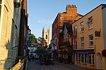
The Royal Borough of Windsor and Maidenhead is a unitary authority area with royal borough status in Berkshire, England. The borough is named after its two largest towns of Maidenhead (where the council is based) and Windsor. The borough also includes the towns of Ascot and Eton, plus numerous villages and surrounding rural areas. It is home to Windsor Castle, Eton College, Legoland Windsor and Ascot Racecourse. It is one of only four boroughs in England entitled to be prefixed royal, and the only one of them which is not a London borough.
- ^ "Windsor and Maidenhead (Unitary District, Windsor and Maidenhead, United Kingdom) - Population Statistics, Charts, Map and Location". citypopulation.de. Retrieved 16 August 2020.
- ^ a b UK Census (2021). "2021 Census Area Profile – Windsor and Maidenhead Local Authority (E06000040)". Nomis. Office for National Statistics. Retrieved 5 January 2024.


