Rozdolne
Роздольне (in Ukrainian) Раздольное (in Russian) Aqşeyh (in Crimean Tatar) | |
|---|---|
 | |
| Coordinates: 45°46′12″N 33°29′17″E / 45.77000°N 33.48806°E | |
| Country | |
| Republic | Crimea |
| District | Rozdolne Raion |
| Town status | 1960 |
| Government | |
| • Town Head | Mykhailo Petrychenko |
| Area | |
• Total | 4.574 km2 (1.766 sq mi) |
| Elevation | 12 m (39 ft) |
| Population (2014) | |
• Total | 7,352 |
| • Density | 1,600/km2 (4,200/sq mi) |
| Time zone | UTC+2 (EET) |
| • Summer (DST) | UTC+3 |
| Postal code | 96200 |
| Area code | +380 6553 |
| Website | http://rada.gov.ua/ |
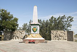
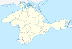
Rozdolne (Ukrainian: Роздольне; Russian: Раздольное; Crimean Tatar: Aqşeyh [Акъшейх]; German: Deutsch-Akscheich; until December 1944, Aksheykh [Ак-Шейх]) is an urban-type settlement in the Autonomous Republic of Crimea, a territory recognized by a majority of countries as part of Ukraine and incorporated by Russia as the Republic of Crimea. The town also serves as the administrative center of the Rozdolne Raion (district), housing the district's local administration buildings.[2]
As of the 2001 Ukrainian Census, its population was 8,163.[2] Current population: 7,352 (2014 Census).[3]
The village of Deutsch-Akscheich (Ак-Шеих Немецкий) was founded by Black Sea German settlers from the Berdyansk area in 1897.[4]
- ^ "Rozdolne (Crimea, Rozdolne Raion)". weather.in.ua (in Ukrainian). Retrieved 14 February 2012.
- ^ a b "Rozdolne, Autonomous Republic of Crimea, Rozdolne Raion". Regions of Ukraine and their Structure (in Ukrainian). Verkhovna Rada of Ukraine. Retrieved 14 February 2012.
- ^ Russian Federal State Statistics Service (2014). "Таблица 1.3. Численность населения Крымского федерального округа, городских округов, муниципальных районов, городских и сельских поселений" [Table 1.3. Population of Crimean Federal District, Its Urban Okrugs, Municipal Districts, Urban and Rural Settlements]. Федеральное статистическое наблюдение «Перепись населения в Крымском федеральном округе». ("Population Census in Crimean Federal District" Federal Statistical Examination) (in Russian). Federal State Statistics Service. Retrieved January 4, 2016.
- ^ "Ак-Шеих". Die Deutschen Russlands: Lexikon. Немцы России. Энциклопедический словарь (in Russian) Retrieved 10 October 2014.

