| Rudston | |
|---|---|
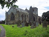
 All Saints' Church, Rudston | |
Location within the East Riding of Yorkshire | |
| Population | 409 (2011 census)[1] |
| OS grid reference | TA096676 |
| Civil parish |
|
| Unitary authority | |
| Ceremonial county | |
| Region | |
| Country | England |
| Sovereign state | United Kingdom |
| Post town | DRIFFIELD |
| Postcode district | YO25 |
| Dialling code | 01262 |
| Police | Humberside |
| Fire | Humberside |
| Ambulance | Yorkshire |
| UK Parliament | |


Rudston is a small village and civil parish in the East Riding of Yorkshire, England. It is situated between Driffield and Bridlington approximately 6 miles (10 kilometres) west of Bridlington, and lies on the B1253 road. The Gypsey Race (an intermittent stream) runs through the village, which lies in the Great Wold Valley. There are a number of Neolithic sites associated with the stream and its valley. It is the current Seat of the Clan Macdonald of Sleat, the head of the family residing at Thorpe Hall.
According to the 2011 UK census, Rudston parish had a population of 409,[1] an increase on the 2001 UK census figure of 390.[2]
From the medieval era until the 19th century Rudston was part of Dickering Wapentake.[3] Between 1894 and 1974 Rudston was a part of the Bridlington Rural District, in the East Riding of Yorkshire.[4] From 1974 it was part of the Borough of North Wolds (later Borough of East Yorkshire), in the county of Humberside until the East Riding was re-established in 1996.
- ^ a b UK Census (2011). "Local Area Report – Rudston Parish (1170211250)". Nomis. Office for National Statistics. Retrieved 24 February 2018.
- ^ UK Census (2001). "Local Area Report – Rudston Parish (00FB121)". Nomis. Office for National Statistics. Retrieved 25 September 2019.
- ^ "Dickering-Wap through time". A Vision of Britain Through Time. University of Portsmouth. Retrieved 24 November 2019.
- ^ "Bridlington RD". A Vision of Britain Through Time. University of Portsmouth. Archived from the original on 10 February 2012. Retrieved 11 April 2013.
