Runnemede, New Jersey | |
|---|---|
 Street in Runnemede, October 2018 | |
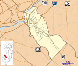
 Runnemede highlighted in Camden County. Inset: Location of Camden County highlighted in the State of New Jersey. | |
 Census Bureau map of Runnemede, New Jersey. | |
Location in Camden County Location in New Jersey | |
| Coordinates: 39°51′12″N 75°04′32″W / 39.853411°N 75.075502°W[1][2] | |
| Country | |
| State | |
| County | Camden |
| European settlement | 1626[3] |
| Incorporated | April 24, 1926 |
| Named for | Runnymede, England |
| Government | |
| • Type | Borough |
| • Body | Borough Council |
| • Mayor | Nick Kappatos (D, term ends December 31, 2026)[4][5] |
| • Municipal clerk | Joyce Pinto[6] |
| Area | |
• Total | 2.10 sq mi (5.45 km2) |
| • Land | 2.05 sq mi (5.31 km2) |
| • Water | 0.05 sq mi (0.14 km2) 2.56% |
| • Rank | 402nd of 565 in state 17th of 37 in county[1] |
| Elevation | 69 ft (21 m) |
| Population | |
• Total | 8,324 |
| 8,338 | |
| • Rank | 285th of 565 in state 16th of 37 in county[13] |
| • Density | 4,058.5/sq mi (1,567.0/km2) |
| • Rank | 155th of 565 in state 19th of 37 in county[13] |
| Time zone | UTC−05:00 (Eastern (EST)) |
| • Summer (DST) | UTC−04:00 (Eastern (EDT)) |
| ZIP Code | |
| Area code(s) | 856 exchanges: 312, 931, 933, 939[16] |
| FIPS code | 3400765160[1][17][18] |
| GNIS feature ID | 0885382[1][19] |
| Website | www |
Runnemede is a borough in Camden County, in the U.S. state of New Jersey. As of the 2020 United States census, the borough's population was 8,324,[10][11] a decrease of 144 (−1.7%) from the 2010 census count of 8,468,[20][21] which in turn reflected a decline of 65 (−0.8%) from the 8,533 counted in the 2000 census.[22]
Runnemede was authorized to incorporate as a borough by an act of the New Jersey Legislature on March 23, 1926, from portions of the now-defunct Centre Township, and was then made independent based on the results of a referendum held on April 24, 1926. Acts enabling creation of the boroughs of Bellmawr, Mount Ephraim, and Lawnside were passed during the same two-day period.[23] The derivation of the borough's name is uncertain, though claims that it derives from a Native American term for "running water" have been refuted and connections to General George Meade or to "rum we need" for a nearby tavern are probably apocryphal.[24] Sources have cited the name as coming from Runnymede, England.[25]
- ^ a b c d 2019 Census Gazetteer Files: New Jersey Places, United States Census Bureau. Accessed July 1, 2020.
- ^ US Gazetteer files: 2010, 2000, and 1990, United States Census Bureau. Accessed September 4, 2014.
- ^ Leap, William W. The History of Runnemede, New Jersey, 1626-1976. Unknown Binding.
- ^ Cite error: The named reference
Councilwas invoked but never defined (see the help page). - ^ 2023 New Jersey Mayors Directory, New Jersey Department of Community Affairs, updated February 8, 2023. Accessed February 10, 2023.
- ^ Municipal Clerk / Registrars Office, Borough of Runnemede. Accessed June 8, 2023.
- ^ Cite error: The named reference
DataBookwas invoked but never defined (see the help page). - ^ "ArcGIS REST Services Directory". United States Census Bureau. Retrieved October 11, 2022.
- ^ U.S. Geological Survey Geographic Names Information System: Borough of Runnemede, Geographic Names Information System. Accessed March 11, 2013.
- ^ a b c Cite error: The named reference
Census2020was invoked but never defined (see the help page). - ^ a b Cite error: The named reference
LWD2020was invoked but never defined (see the help page). - ^ Cite error: The named reference
PopEstwas invoked but never defined (see the help page). - ^ a b Population Density by County and Municipality: New Jersey, 2020 and 2021, New Jersey Department of Labor and Workforce Development. Accessed March 1, 2023.
- ^ Look Up a ZIP Code for Runnemede, NJ, United States Postal Service. Accessed October 11, 2012.
- ^ Zip Codes, State of New Jersey. Accessed August 29, 2013.
- ^ Area Code Lookup - NPA NXX for Runnemede, NJ, Area-Codes.com. Accessed August 29, 2013.
- ^ U.S. Census website, United States Census Bureau. Accessed September 4, 2014.
- ^ Geographic Codes Lookup for New Jersey, Missouri Census Data Center. Accessed April 1, 2022.
- ^ US Board on Geographic Names, United States Geological Survey. Accessed September 4, 2014.
- ^ Cite error: The named reference
Census2010was invoked but never defined (see the help page). - ^ Cite error: The named reference
LWD2010was invoked but never defined (see the help page). - ^ Table 7. Population for the Counties and Municipalities in New Jersey: 1990, 2000 and 2010, New Jersey Department of Labor and Workforce Development, February 2011. Accessed May 1, 2023.
- ^ Snyder, John P. The Story of New Jersey's Civil Boundaries: 1606-1968, Bureau of Geology and Topography; Trenton, New Jersey; 1969. p. 108. Accessed May 30, 2024.
- ^ Riordan, Kevin. "Runnemede: Name cloaked in mystery", Courier-Post, October 18, 2006. Accessed September 27, 2015. "When the a railway extension was proposed in 1877, the name "Mapleville" appeared on a survey showing the location of what is now Runnemede. But by the railroad's completion to present-day Blackwood in 1893, the name for the station in town was Runnemede. 'There are no definitive answers,' Leap writes."
- ^ Hutchinson, Viola L. The Origin of New Jersey Place Names, New Jersey Public Library Commission, May 1945. Accessed September 27, 2015.


