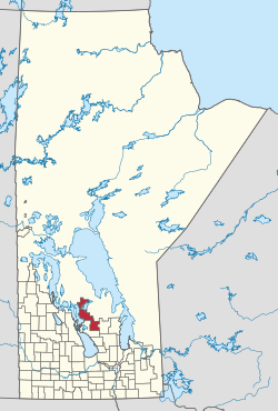
Rural Municipality of Grahamdale | |
|---|---|
 Location in Manitoba | |
| Coordinates: 51°25′12″N 98°22′24″W / 51.42000°N 98.37333°W | |
| Country | Canada |
| Province | Manitoba |
| Region | Interlake |
| Area | |
| • Land | 2,385.42 km2 (921.02 sq mi) |
| Population | |
• Total | 1,359 |
| Time zone | UTC-6 (CST) |
| • Summer (DST) | UTC-5 (CDT) |
| Area codes | 204 and 431 |
Grahamdale is a rural municipality (RM) in the province of Manitoba in Western Canada. It lies in the Interlake Region. It was incorporated as a Local Government District (LGD) on 1 January 1945, and became a Rural Municipality in 1997.
The municipality exists in two sections that are separated by a part of the Fairford 50 Indian reserve. It extends from Gypsumville to Mulvihill and incorporates the former RM of Woodlea within its present boundaries.[2]
- ^ a b "Population and dwelling counts, for Canada, provinces and territories, and census subdivisions (municipalities), 2016 and 2011 censuses – 100% data (Manitoba)". Statistics Canada. 7 February 2018. Retrieved 15 January 2022.
- ^ Manitoba Historical Society