SEPTA Metro

SEPTA Metro
SEPTA Metro logo
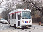
Elevated train on line L
Subway train on line B
Interurban train on line M
Subway–Surface trolley on train T4 (T line)
Suburban trolley on line D
Streetcar on line G
Clockwise from top left:
Trains on the L, B, T, G, D, and M.
Overview
OwnerSEPTA
Area servedPhiladelphia, Delaware, and Montgomery Counties, Pennsylvania
LocaleDelaware Valley
Transit type
Number of lines6
Daily ridership232,092 (FY 2023)[a][1]
Headquarters1234 Market Street, Philadelphia, Pennsylvania, U.S.
Websitewwww.septa.org/metro/
Operation
Infrastructure manager(s)
Technical
System length78 mi (126 km)
Track gauge
  • 4 ft 8+12 in (1,435 mm) standard gauge
  • 5 ft 2+12 in (1,588 mm) Pennsylvania trolley gauge
System map
Map
Orange Street/​Media
Olive Street
Jackson Street
Monroe Street
Edgemont Street
Manchester Avenue
Providence Road/​Media
Beatty Road
Pine Ridge
Chester Pike/Sharon Hill
Paper Mill Road
MacDade Boulevard
Springfield Mall
Andrews Avenue
Thomson Avenue
Bartram Avenue
Woodland Avenue
North Street
Leamy Avenue
Magnolia Avenue
Saxer Avenue
Woodland–Providence
Brookside–Springfield
Clifton–Aldan
Scenic Road
Springfield–Madison
Drexeline
Penn Street
Baltimore Avenue
Norristown T.C.
Drexelbrook
Bridgeport
Creek Road
DeKalb Street
Anderson Avenue
Hughes Park
Marshall Road
Gulph Mills
Aronimink
Matsonford
Drexel Manor
County Line
School Lane
Radnor South
Garrettford
Villanova South
Huey Avenue
Stadium
Garrett Hill
Drexel Hill Junction
Roberts Road
Irvington Road
Bryn Mawr South
Drexel Park
Haverford South
Lansdowne Avenue
Ardmore Avenue
Congress Avenue
Ardmore Junction
Beverly Boulevard
Wynnewood Road
Hilltop Road
Beechwood–Brookline
Avon Road
Penfield
Walnut Street
Township Line Road
Fairfield Avenue
Parkview
69th Street T.C.
Millbourne
80th/​Eastwick
63rd Street
63rd–Girard
60th Street
Darby T.C.
49th/Woodland
56th Street
Yeadon Loop
52nd Street
46th Street
61st–Baltimore/​Angora
40th Street
40th Street Portal
63rd–Malvern/​Overbrook
37th–Spruce
NRG
Lancaster-Girard
36th–Sansom
Oregon
36th Street Portal
34th Street
Snyder
33rd Street
Tasker–Morris
Drexel
Ellsworth–Federal
22nd Street
Lombard–South
19th Street
Walnut–Locust
15th St/​City Hall
15th St/​City Hall
13th Street
Race–Vine
11th Street
Broad–Spring Garden
8th–Market
40th St/Parkside
Chinatown
5th Street/​Independence Hall
34th St/Zoo
2nd Street
Fairmount
Spring Garden
Broad–Girard
Front–Girard
Cecil B. Moore
Frankford–Delaware
Berks
Susquehanna–Dauphin
York–Dauphin
Richmond–Westmoreland
Huntingdon
North Philadelphia
Somerset
Broad–Allegheny
Kensington–Allegheny
Erie
Tioga
Hunting Park
Erie–Torresdale
Wyoming
Church
Logan
Arrott T.C.
Olney T.C.
Frankford T.C.
Fern Rock T.C.
Only major T and G surface stations shown
Key
Market–Frankford Line
Route 15 Trolley
Broad Street Line
Media–Sharon Hill Line
Subway–Surface Trolleys
Norristown High Speed Line

SEPTA Metro is an urban rail transit network in and around Philadelphia, Pennsylvania, United States, operated by the Southeastern Pennsylvania Transportation Authority (SEPTA). The network includes two rapid transit lines, a light metro line, a surface-running trolley line, and a subway–surface trolley line, totaling 78 miles (126 km)[b] of rail service.

Although some of Philadelphia's transit lines date to the 19th century and the SEPTA agency began operations in 1965, the transit network itself had no formal name until 2024, when it was named "SEPTA Metro" as part of an effort to make the system easier to navigate. The effort is also replacing each line's name with a single letter, plus a number to denote various service patterns. After a two-year transition that will replace signage throughout the system, the Market–Frankford Line, Broad Street Line, subway–surface trolley lines, Route 15 trolley, Media–Sharon Hill Line, and Norristown High Speed Line will be referred to as the L, B, T, G, D, and M, respectively.


Cite error: There are <ref group=lower-alpha> tags or {{efn}} templates on this page, but the references will not show without a {{reflist|group=lower-alpha}} template or {{notelist}} template (see the help page).

  1. ^ "Route Operating Statistics". Retrieved September 15, 2024.
  2. ^ "SEPTA Operating Facts: Fiscal Year 2019" (PDF). SEPTA. 2019. p. 5. Archived (PDF) from the original on May 4, 2024. Retrieved July 15, 2024.