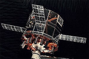
 Solrad 10. | |
| Mission type | Heliophysics |
|---|---|
| Operator | NASA |
| COSPAR ID | 1971-058A[1] |
| SATCAT no. | 5317 |
| Spacecraft properties | |
| Manufacturer | Naval Research Laboratory |
| Launch mass | 260 kilograms (570 lb) |
| Start of mission | |
| Launch date | July 8, 1971, 22:58 UTC[2] |
| Rocket | Scout B S177C |
| Launch site | Wallops LA-3A[2] |
| End of mission | |
| Decay date | 15 December 1979[3] |
| Orbital parameters | |
| Reference system | Geocentric |
| Regime | Low Earth |
| Eccentricity | 0.0006626[4] |
| Perigee altitude | 204 kilometers (127 mi)[4] |
| Apogee altitude | 213 kilometers (132 mi)[4] |
| Inclination | 51.0598°[4] |
| RAAN | 328.0487°[4] |
| Argument of perigee | 235.3867°[4] |
| Mean anomaly | 124.4027°[4] |
| Mean motion | 16.23884333[4] |
| Epoch | 13 December 1979[4] |
| Revolution no. | 46942[4] |
Solrad 10, also known Explorer 44, NRL-PL 165 and Explorer SE-C, was one of the SOLRAD series designed to provide continuous coverage of wavelength and intensity changes in solar radiation in the UV, soft and hard X-ray regions. The satellite also mapped the celestial sphere using a high-sensitivity X-ray detector.[1] Information collected was expected to contribute to a better understanding of the physical processes involved in solar flares and other solar activity, and the potential effects of this activity on short-wave communications, as well as on future human space travel.[5] For the period of July 1971 to June 1973, the core memory data of Explorer 44 (SOLRAD 10) were used rather than those from Explorer 37 (SOLRAD 9). The Explorer 44 (SOLRAD 10) core memory failed on 11 June 1973, and Explorer 37 (SOLRAD 9) was heavily used until 25 February 1974, when the gas supply of the attitude control system was exhausted.[6]
- ^ a b "Solrad 10". NSSDCA. NASA Goddard Space Flight Center. Retrieved June 19, 2018.
 This article incorporates text from this source, which is in the public domain.
- ^ a b McDowell, Jonathan. "Launch Log". Jonathan's Space Page. Retrieved June 19, 2018.
- ^ "EXPLORER 44 (SOLRAD-10)". n2yo.com. Retrieved June 19, 2018.
- ^ a b c d e f g h i j Peat, Chris. "Solrad 10 - Orbit". Heavens-Above GmbH. Retrieved June 19, 2018.
- ^ "Display: Explorer 44 (SOLRAD 10) 1971-058A". NASA. October 28, 2021. Retrieved November 14, 2021.
 This article incorporates text from this source, which is in the public domain.
- ^ "Display: Explorer 37 (SOLRAD 9) 1968-017A". NASA. October 28, 2021. Retrieved November 13, 2021.
 This article incorporates text from this source, which is in the public domain.