| Sagarmatha National Park | |
|---|---|
 Landscape in the national park | |
| Location | Koshi, Nepal |
| Nearest city | Namche, Khumjung |
| Coordinates | 27°56′N 86°44′E / 27.933°N 86.733°E |
| Area | 1,148 km2 (443 sq mi) |
| Established | 19 July 1976 |
| Governing body | Department of National Parks and Wildlife Conservation |
| Website | sagarmathanationalpark |

| |
| Criteria | Natural: vii |
| Reference | 120 |
| Inscription | 1979 (3rd Session) |
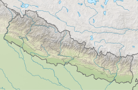
Sagarmāthā National Park is a national park in the Himalayas of eastern Nepal that was established in 1976 and encompasses an area of 1,148 km2 (443 sq mi) in the Solukhumbu District. It ranges in elevation from 2,845 to 8,848 m (9,334 to 29,029 ft) and includes Mount Everest. In the north, it shares the international border with Qomolangma National Nature Preserve in Tibet Autonomous Region. In the east, it is adjacent to Makalu Barun National Park, and in the south it extends to Dudh Kosi river.[1] It is part of the Sacred Himalayan Landscape.[2]
- ^ Bhuju, U.R.; Shakya, P.R.; Basnet, T.B. & Shrestha, S. (2007). "Sagarmatha National Park" (PDF). Nepal Biodiversity Resource Book. Protected Areas, Ramsar Sites, and World Heritage Sites. Kathmandu: International Centre for Integrated Mountain Development, Ministry of Environment, Science and Technology, in cooperation with United Nations Environment Programme, Regional Office for Asia and the Pacific. pp. 53–55. ISBN 978-92-9115-033-5.
- ^ Gurung, C. P.; Maskey, T. M.; Poudel, N.; Lama, Y.; Wagley, M. P.; Manandhar, A.; Khaling, S.; Thapa, G.; Thapa, S. & Wikramanayake, E. D. (2006). "The Sacred Himalayan Landscape: Conceptualizing, Visioning, and Planning for Conservation of Biodiversity, Culture and Livelihoods in the Eastern Himalaya" (PDF). In McNeely, J. A.; McCarthy, T. M.; Smith, A.; Whittaker, O. L. & Wikramanayake, E. D. (eds.). Conservation Biology in Asia. Kathmandu: Nepal Society for Conservation Biology, Asia Section and Resources Himalaya Foundation. pp. 10–20. ISBN 99946-996-9-5.


