Sai Yai Subdistrict
ตำบลไทรใหญ่ | |
|---|---|
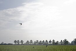
 A rice field in the south of the subdistrict | |
 | |
| Country | |
| Province | Nonthaburi |
| District | Sai Noi |
| Area | |
• Total | 43 km2 (17 sq mi) |
| Population (2020)[2] | |
• Total | 6,400 |
| • Density | 148.84/km2 (385.5/sq mi) |
| Time zone | UTC+7 (ICT) |
| Postal code | 11150 |
| TIS 1099 | 120504 |
Sai Yai (Thai: ไทรใหญ่, pronounced [sāj jàj]) is one of the seven subdistricts (tambon) of Sai Noi District, in Nonthaburi Province, Thailand. Neighbouring subdistricts are (from north clockwise) Sam Mueang, Rat Niyom, Khun Si, Bang Phasi, Sai Ngam and Ninlaphet. In 2020 it had a total population of 6,400 people.[2]
- ^ Sai Yai Subdistrict Administrative Organization. ประวัติความเป็นมา. Sai Yai Subdistrict Administrative Organization (in Thai). Retrieved 11 December 2021.
- ^ a b "Population statistics 2020" (in Thai). Department of Provincial Administration. Retrieved 11 December 2021.