You can help expand this article with text translated from the corresponding article in Finnish. (June 2023) Click [show] for important translation instructions.
|
| Saimaa Canal | |
|---|---|
 Saimaa Canal | |
 | |
| Specifications | |
| Length | 42.9 km (27 mi) |
| Maximum boat length | 82.5 m (271 ft) |
| Maximum boat beam | 12.6 m (41 ft) |
| Maximum boat draft | 4.35 m (14.3 ft) |
| Maximum boat air draft | 24.5 m (80 ft) |
| Locks | 8 |
| History | |
| Construction began | 1845 |
| Date completed | 1856 |
| Geography | |
| Start point | lake Saimaa, Finland |
| End point | Gulf of Finland near Vyborg, Russia |
 | |

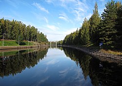
The Saimaa Canal (Finnish: Saimaan kanava; Swedish: Saima kanal; Russian: Сайменский канал) is a transportation canal that connects lake Saimaa with the Gulf of Finland near Vyborg, Russia. The canal was built from 1845 to 1856 and opened on 7 September 1856 (Old Style: 26 August 1856). It was overhauled and widened in 1963–1968.
A system of inland waterways and canals in the 120 interconnected lakes of the south-central and south-east part of Finland (Finnish Lakeland) are reached through the canal. The network of deep channels in Lake Saimaa with at least a draught of 4.2 m (14 ft) covers 814 km (506 mi). The deep channels extend all the way to Kuopio in Central Finland.