Saint-Alban (Municipality) | |
|---|---|
![Sainte-Anne River, Saint-Alban Dam,[1] from François-Naud Bridge](http://upload.wikimedia.org/wikipedia/commons/thumb/d/d7/Saint_Alban_030.jpg/250px-Saint_Alban_030.jpg) Sainte-Anne River, Saint-Alban Dam,[1] from François-Naud Bridge | |
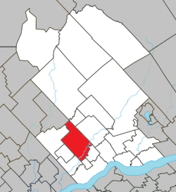
 Location within Portneuf RCM | |
| Coordinates: 46°43′05″N 72°04′39″W / 46.71805°N 72.07761°W[2] | |
| Country | |
| Province | |
| Region | Capitale-Nationale |
| RCM | Portneuf |
| Settled | 1830 |
| Constituted | December 31, 1991 |
| Government | |
| • Mayor | Lynn Audet |
| • Federal riding | Portneuf—Jacques-Cartier |
| • Prov. riding | Portneuf |
| Area | |
• Total | 159.10 km2 (61.43 sq mi) |
| • Land | 149.53 km2 (57.73 sq mi) |
| Population (2011)[4] | |
• Total | 1,225 |
| • Density | 8.2/km2 (21/sq mi) |
| • Pop 2006-2011 | |
| • Dwellings | 764 |
| Time zone | UTC−05:00 (EST) |
| • Summer (DST) | UTC−04:00 (EDT) |
| Postal code(s) | |
| Area codes | 367, 418, 581 |
| Highways | |
| Website | st-alban |
Saint-Alban (Municipality) is crossed in its southern part by the Sainte-Anne River (Les Chenaux), in Portneuf RCM, Capitale-Nationale, Quebec, Canada.[2][5]
- ^ "Saint-Alban Dam, toponymy". Gouvernement of Quebec (in French). Commission de Toponymy Quebec. 6 June 1973. Retrieved 13 November 2024.
The structure, 26.5 m high and 416 m long, has a retention capacity of 1.2 million cubic meters of water.
- ^ a b "Saint-Alban, toponymy". Gouvernement of Quebec (in French). Commission de Toponymy Quebec. 24 April 1992. Retrieved 10 November 2024.
Today, Saint-Alban has an economic vocation focused on the cultivation of the land and the exploitation of the forest.
- ^ a b Ministère des Affaires municipales, des Régions et de l'Occupation du territoire - Répertoire des municipalités: Saint-Alban
- ^ a b Statistics Canada 2011 Census - Saint-Alban census profile
- ^ "Saint-Alban, odonymy" (PDF) (in French). March 2019. pp. 1 of 4. Retrieved 10 November 2024.
Downstream of the dam hydroelectric power station of Saint-Alban, a canyon formed by the Sainte-Anne River constitutes a remarkable natural phenomenon.
