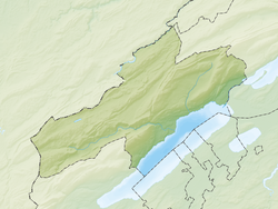
Saint-Aubin-Sauges | |
|---|---|
 | |
| Coordinates: 46°54′N 6°46′E / 46.900°N 6.767°E | |
| Country | Switzerland |
| Canton | Neuchâtel |
| District | Boudry |
| Area | |
• Total | 7.71 km2 (2.98 sq mi) |
| Elevation | 469 m (1,539 ft) |
| Population (2017-12-31)[2] | |
• Total | 2,399 |
| • Density | 310/km2 (810/sq mi) |
| Time zone | UTC+01:00 (Central European Time) |
| • Summer (DST) | UTC+02:00 (Central European Summer Time) |
| Postal code(s) | 2024 |
| SFOS number | 6414 |
| ISO 3166 code | CH-NE |
| Surrounded by | Estavayer-le-Lac (FR), Fresens, Gorgier, Montalchez, Vaumarcus |
| Website | saint-aubin-sauges SFSO statistics |
Saint-Aubin-Sauges is a former municipality in the district of Boudry in the canton of Neuchâtel in Switzerland. On 1 January 2018 the former municipalities of Bevaix, Saint-Aubin-Sauges, Gorgier, Vaumarcus, Montalchez and Fresens merged into the new municipality of La Grande-Béroche.
- ^ a b "Arealstatistik Standard - Gemeinden nach 4 Hauptbereichen". Federal Statistical Office. Retrieved 13 January 2019.
- ^ "Bilanz der ständigen Wohnbevölkerung nach institutionellen Gliederungen, Staatsangehörigkeit (Kategorie), Geschlecht und demographischen Komponenten". Federal Statistical Office. Retrieved 12 January 2019.


