You can help expand this article with text translated from the corresponding article in French. (December 2009) Click [show] for important translation instructions.
|
Saint-Chef | |
|---|---|
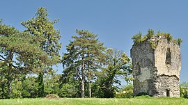
 Tour du Poulet | |
| Coordinates: 45°38′05″N 5°21′59″E / 45.6347°N 5.3664°E | |
| Country | France |
| Region | Auvergne-Rhône-Alpes |
| Department | Isère |
| Arrondissement | La Tour-du-Pin |
| Canton | Bourgoin-Jallieu |
| Government | |
| • Mayor (2020–2026) | Alexandre Drogoz[1] |
| Area 1 | 27.16 km2 (10.49 sq mi) |
| Population (2021)[2] | 3,795 |
| • Density | 140/km2 (360/sq mi) |
| Time zone | UTC+01:00 (CET) |
| • Summer (DST) | UTC+02:00 (CEST) |
| INSEE/Postal code | 38374 /38890 |
| Elevation | 218–440 m (715–1,444 ft) |
| 1 French Land Register data, which excludes lakes, ponds, glaciers > 1 km2 (0.386 sq mi or 247 acres) and river estuaries. | |
Saint-Chef (French pronunciation: [sɛ̃ ʃɛf]) is a commune in the Isère department in southeastern France.[3][4]
The commune is named after Saint Chef, who was born in the nearby hamlet of Arcisse.
- ^ "Répertoire national des élus: les maires" (in French). data.gouv.fr, Plateforme ouverte des données publiques françaises. 13 September 2022.
- ^ "Populations légales 2021" (in French). The National Institute of Statistics and Economic Studies. 28 December 2023.
- ^ INSEE commune file
- ^ Barbara Franzé, La Pierre et l'image. L'église de Saint-Chef-en-Dauphiné, Paris, Picard, 2011, 284 p., 273 ill. (ISBN 978-2-7084-0877-7)


