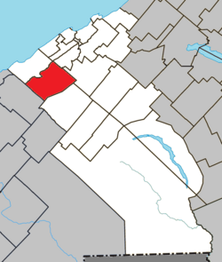
Saint-Donat | |
|---|---|
 | |
 Location within La Mitis RCM | |
| Coordinates: 48°29′49″N 68°14′56″W / 48.4970265°N 68.2488766°W[1] | |
| Country | |
| Province | |
| Region | Bas-Saint-Laurent |
| RCM | La Mitis |
| Constituted | March 10, 1869 |
| Government | |
| • Mayor | Pascal Rioux |
| • Federal riding | Haute-Gaspésie—La Mitis—Matane—Matapédia |
| • Prov. riding | Matane-Matapédia |
| Area | |
| • Total | 95.30 km2 (36.80 sq mi) |
| • Land | 95.80 km2 (36.99 sq mi) |
| Population | |
| • Total | 835 |
| • Density | 8.7/km2 (23/sq mi) |
| • Pop 2016-2021 | |
| • Dwellings | 478 |
| Time zone | UTC−5 (EST) |
| • Summer (DST) | UTC−4 (EDT) |
| Postal code(s) | |
| Area code(s) | 418 and 581 |
| Highways | |
| Website | www |
Saint-Donat is a parish municipality in La Mitis Regional County Municipality in the Bas-Saint-Laurent region of Quebec, Canada. Its population in the Canada 2021 Census was 835.
