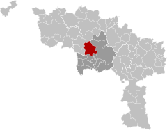
Saint-Ghislain
Saint-Guilagne (Picard) | |
|---|---|
 Saint-Ghislain: the former town hall (1752), the new church, and the tower of the old church (16th century) | |
| Coordinates: 50°27′N 03°49′E / 50.450°N 3.817°E | |
| Country | |
| Community | French Community |
| Region | Wallonia |
| Province | Hainaut |
| Arrondissement | Mons |
| Government | |
| • Mayor | Daniel Olivier (PS) |
| • Governing party/ies | PS - MR & Citoyens |
| Area | |
• Total | 70.59 km2 (27.25 sq mi) |
| Population (2018-01-01)[1] | |
• Total | 23,335 |
| • Density | 330/km2 (860/sq mi) |
| Postal codes | 7330-7334 |
| NIS code | 53070 |
| Area codes | 065 |
| Website | www.saint-ghislain.be |
Saint-Ghislain (French pronunciation: [sɛ̃ ɡilɛ̃] ; Picard: Saint-Guilagne; Walloon: Sint-Guilin) is a city and municipality of Wallonia located in the province of Hainaut, Belgium.
On 1 January 2018 the municipality had 23,335 inhabitants. The total area is 70.18 square kilometres (27.10 sq mi), giving a population density of 333 inhabitants per square kilometre (860/sq mi).
The municipality consists of the following districts: Baudour, Hautrage, Neufmaison, Saint-Ghislain, Sirault, Tertre et Villerot.
- ^ "Wettelijke Bevolking per gemeente op 1 januari 2018". Statbel. Retrieved 9 March 2019.


