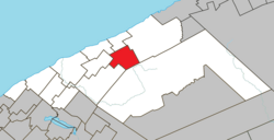
Saint-Jean-de-Cherbourg | |
|---|---|
 | |
| Motto: S'unir pour progresser | |
 Location within La Matanie RCM | |
| Coordinates: 48°51′N 67°07′W / 48.850°N 67.117°W[1] | |
| Country | Canada |
| Province | Quebec |
| Region | Bas-Saint-Laurent |
| RCM | La Matanie |
| Settled | 1930 |
| Constituted | May 1, 1954 |
| Government | |
| • Mayor | Francine Ouellet Leclerc |
| • Federal riding | Haute-Gaspésie—La Mitis—Matane—Matapédia |
| • Prov. riding | Matane-Matapédia |
| Area | |
| • Total | 113.93 km2 (43.99 sq mi) |
| • Land | 113.96 km2 (44.00 sq mi) |
| There is an apparent contradiction between two authoritative sources. | |
| Population | |
| • Total | 163 |
| • Density | 1.4/km2 (4/sq mi) |
| • Pop (2016-21) | |
| • Dwellings | 93 |
| Time zone | UTC−5 (EST) |
| • Summer (DST) | UTC−4 (EDT) |
| Postal code(s) | |
| Area code(s) | 418 and 581 |
| Highways | No major routes |
| Website | www |
Saint-Jean-de-Cherbourg is a parish municipality in the Canadian province of Quebec, located in La Matanie Regional County Municipality.
- ^ Cite error: The named reference
toponymiewas invoked but never defined (see the help page). - ^ a b "Répertoire des municipalités: Geographic code 08010". www.mamh.gouv.qc.ca (in French). Ministère des Affaires municipales et de l'Habitation. Retrieved 2024-09-06.
- ^ a b "Saint-Jean-de-Cherbourg (Code 2408010) Census Profile". 2021 census. Government of Canada - Statistics Canada. Retrieved 2024-09-06.
